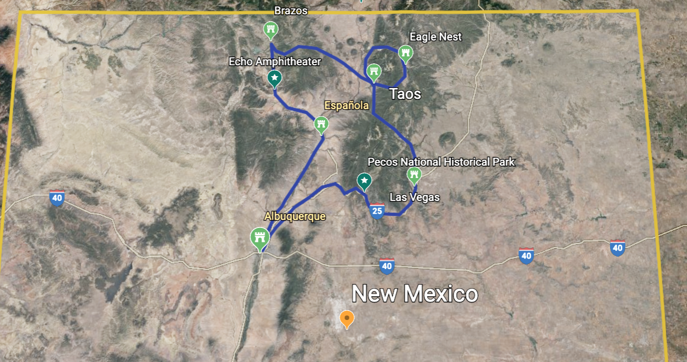
Part I: NORTH-WEST
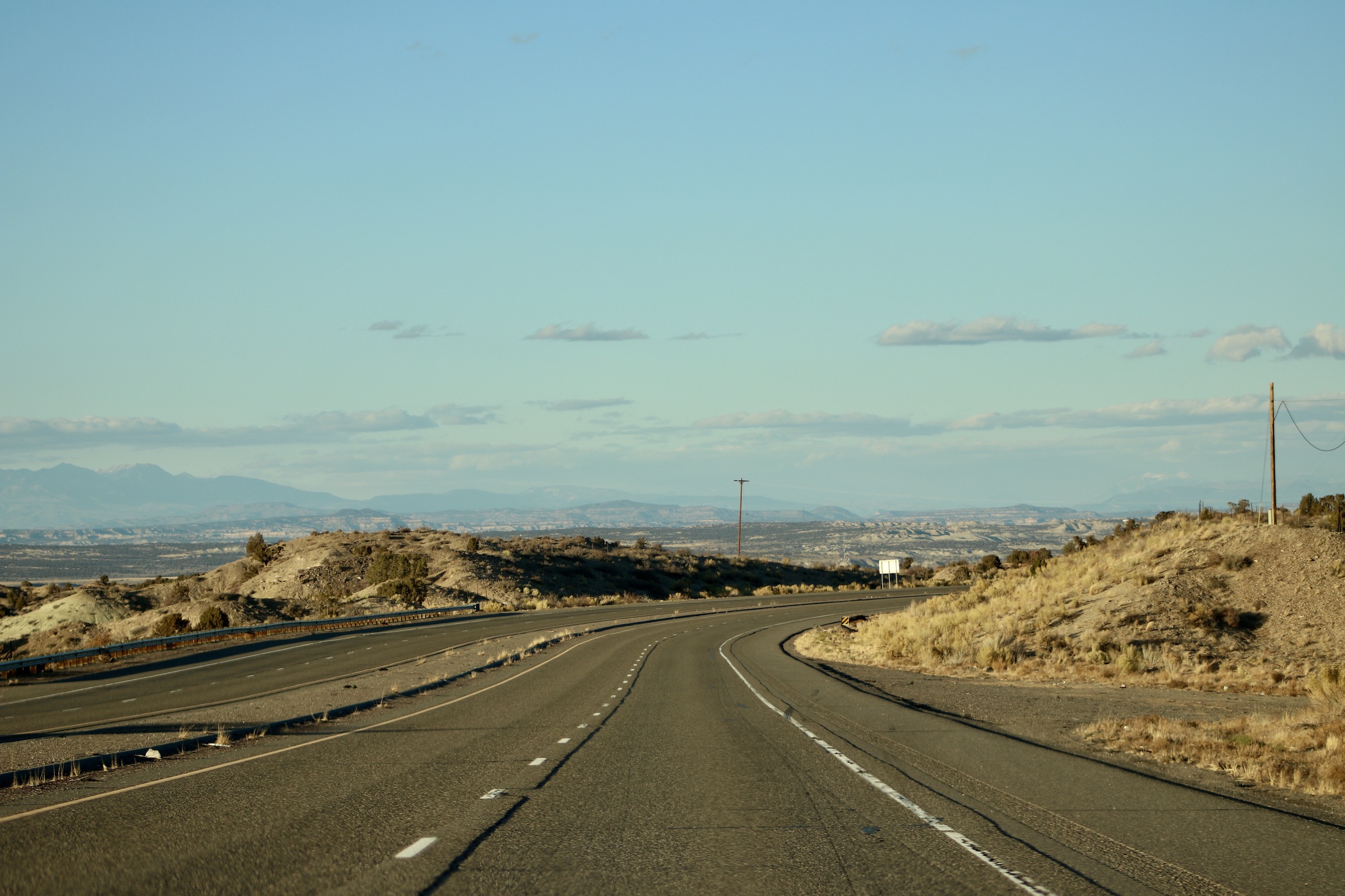
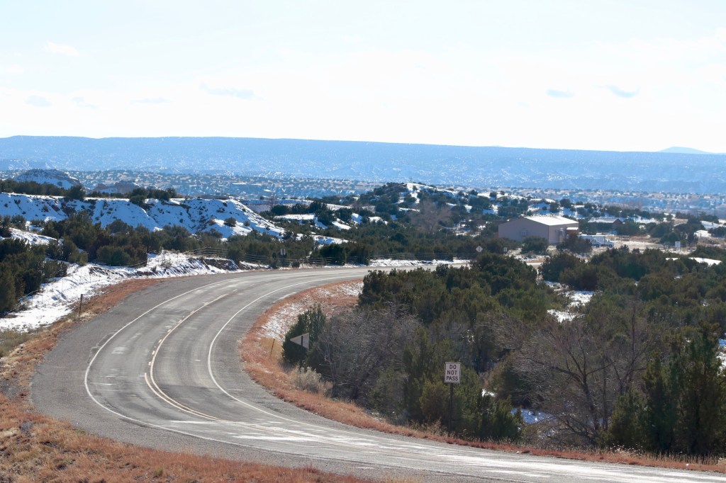
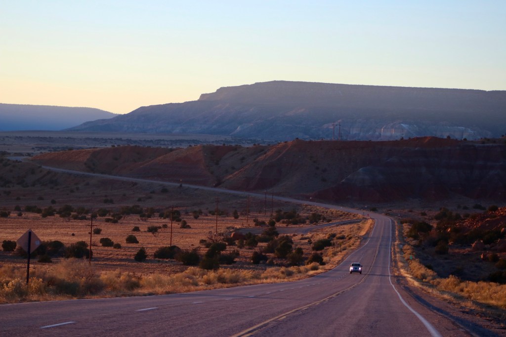
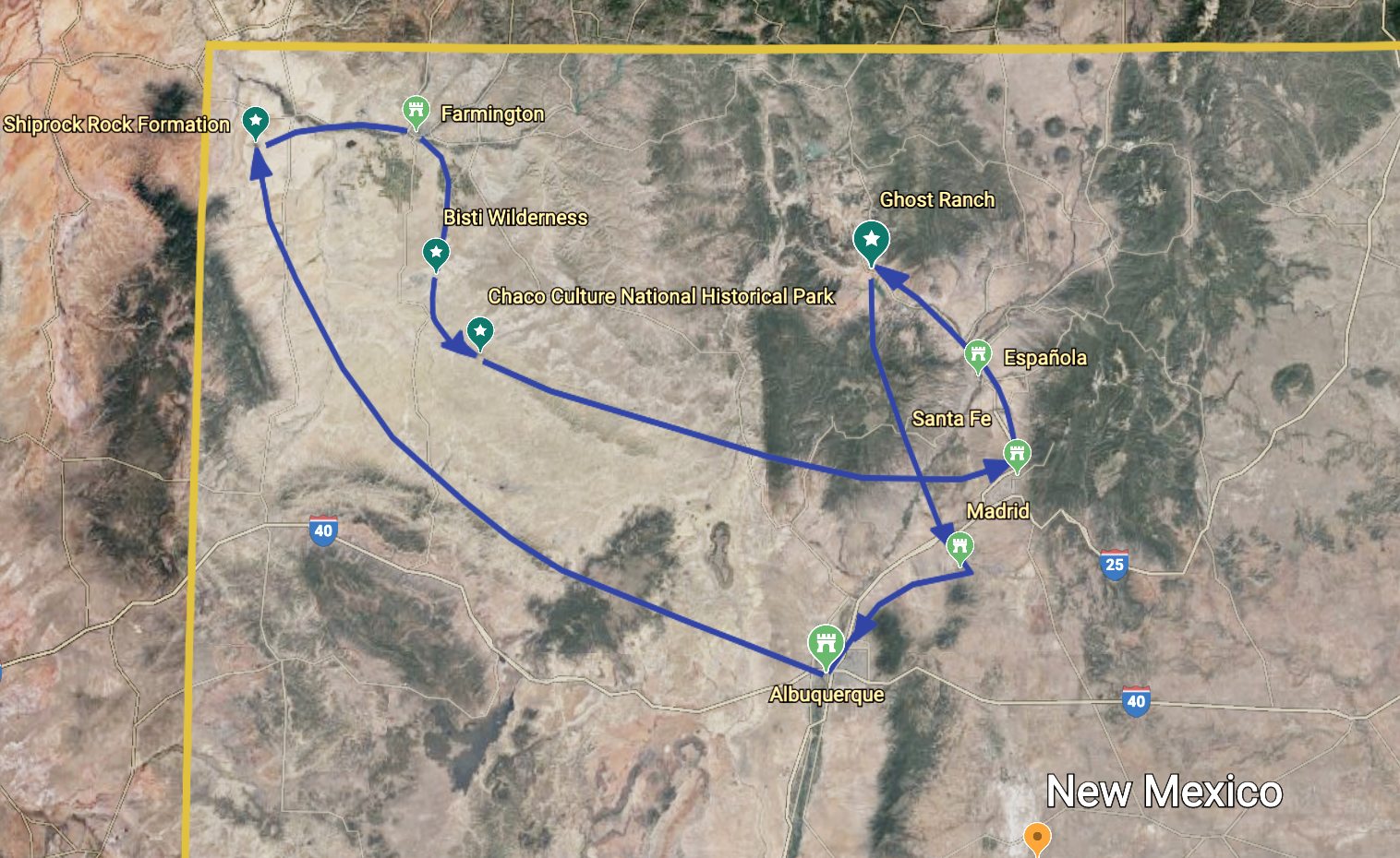
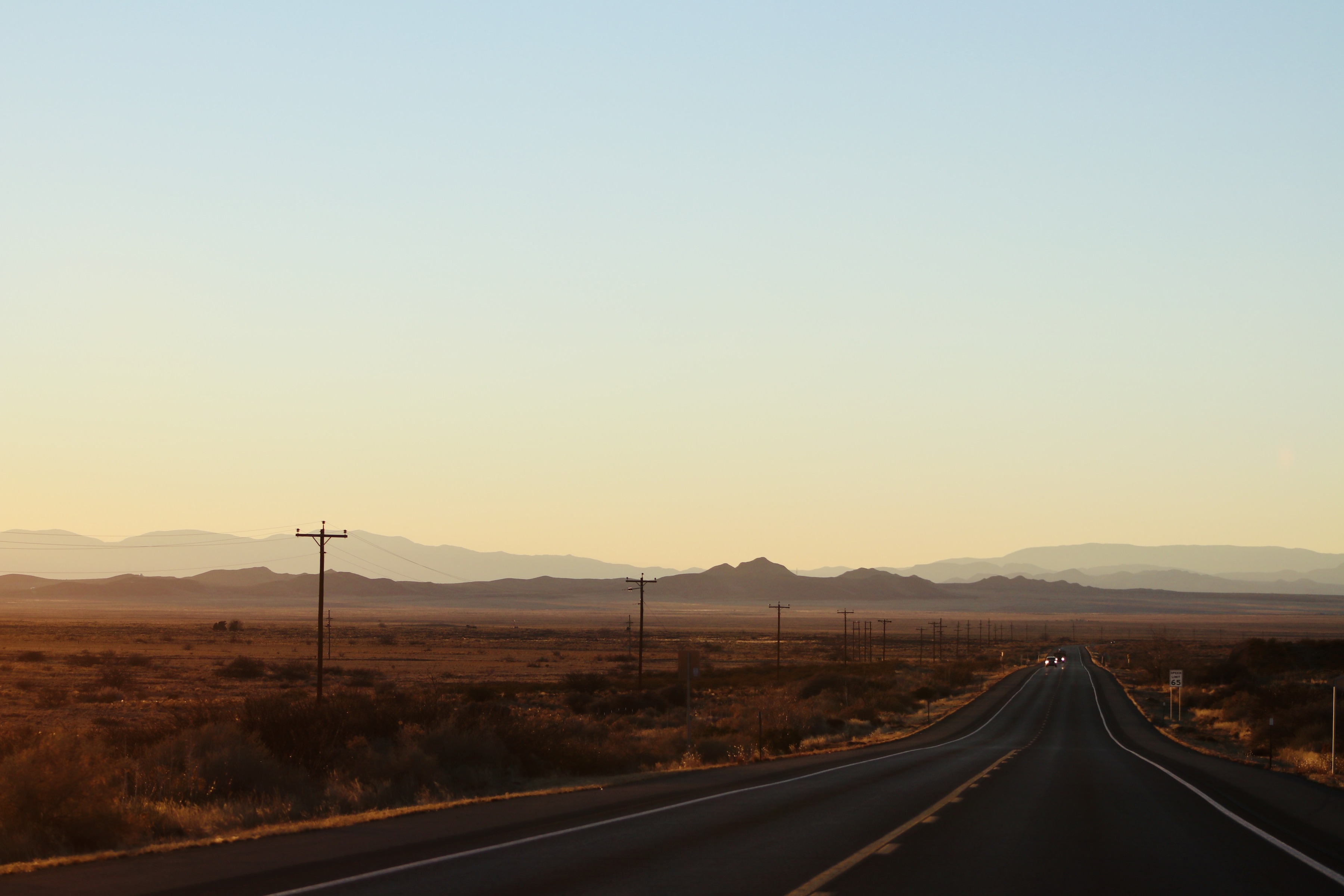
Hot, dry air. Bright sun. Albuquerque. We exited a small airport and paused to take in the otherness of our surroundings. For someone coming here from the region of lush rainforests, misty ocean shores, and snow-capped mounts, this was indeed a preface to experiencing a very different edge of the world. Being roughly at the center of New-Mexico, we had a choice of heading north, into the cooler alpine highlands, or south, into the arid areas of parched lands and deserts. We hopped into the car and headed northbound on highway 550, which was to take us to Farmington on that glorious Thanksgiving day. Wide roads, light traffic, uninhibited 360° views of canyons and ridges in the distance. High speed seemed natural on such an open road. Occasionally, heavily-loaded trucks would run in the opposite direction. No sight of cattle or cultivated crops… and yet, the hazel-hued land didn’t appear deserted….it appeared ancient, rough and intact.
An hour and a half into the trip, hunger made itself known to me. I found nothing but chocolates in my bag, but that was sufficient. As we approached the settlement of Cuba, which I had imagined to be a cozy tourist-friendly town, I discovered the very opposite – Cuba turned out to be desolate and even ghostly. Soon I would realize that Cuba-like towns aren’t uncommon for New Mexico. I saw no humans on the streets, while the only signs of life were farm carts sitting here and there and dogs, giving us curious looks or protectively yapping as we were driving by the small, unsightly houses.
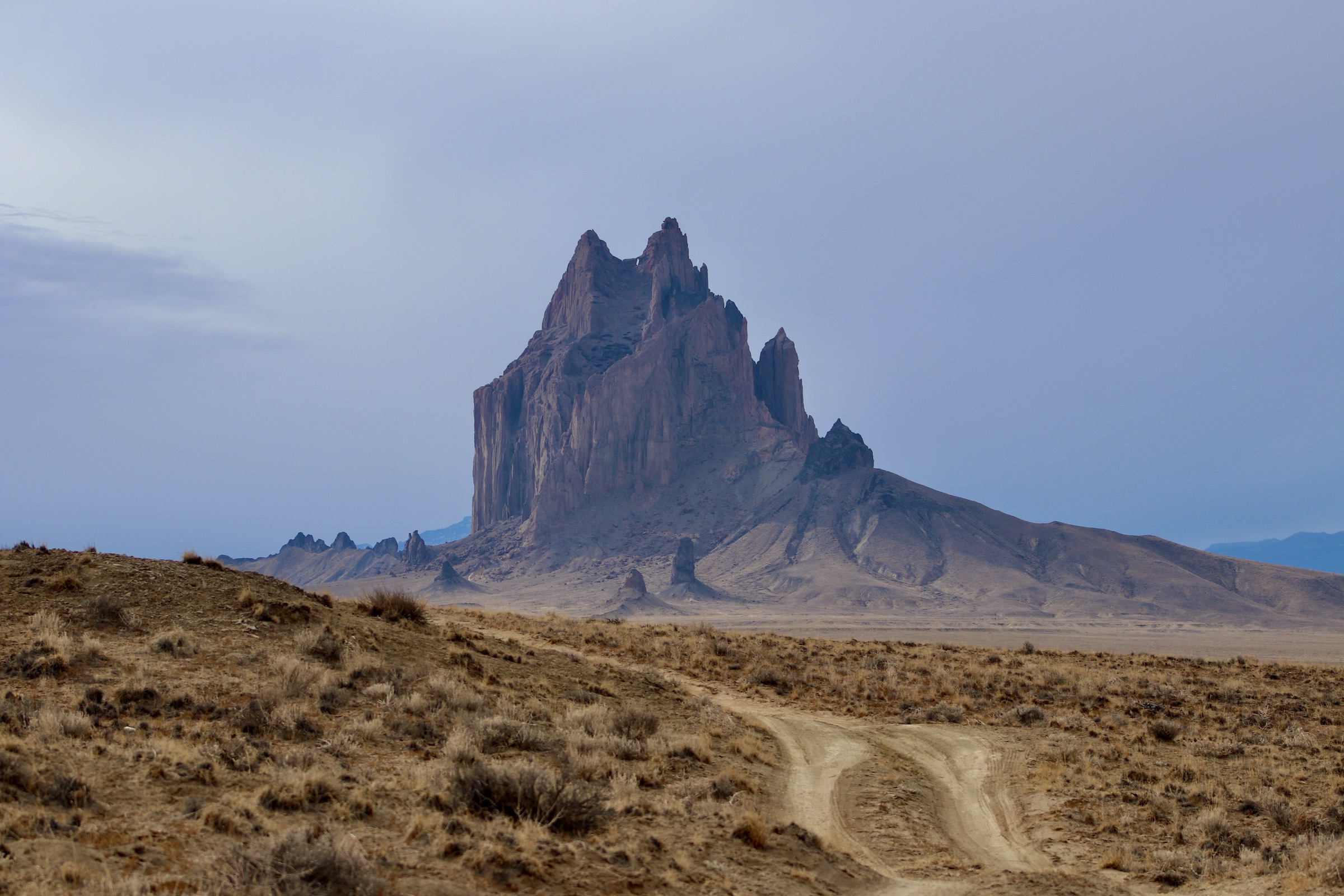
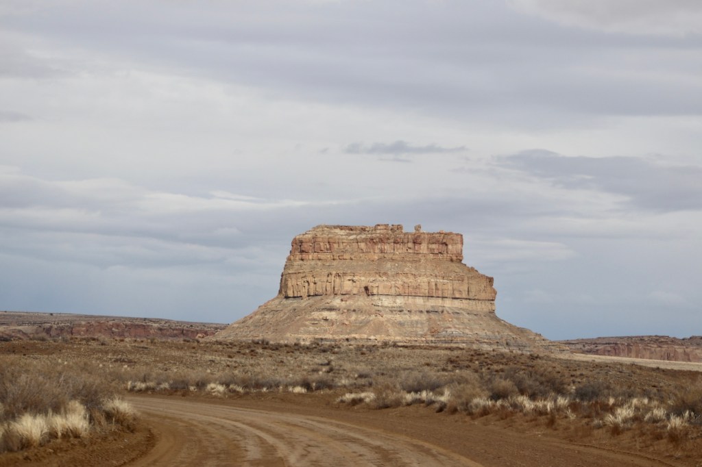
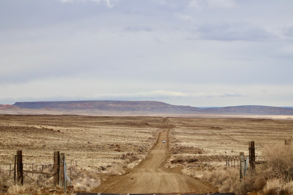
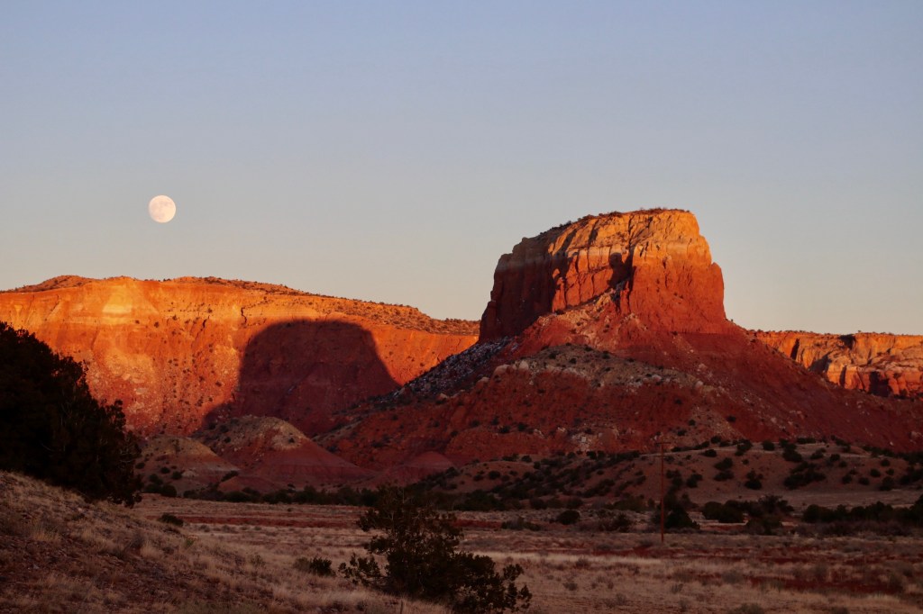
The trip went on and we were approaching Farmington. Upon entering the town, we were pleased to notice some diversity and color in an otherwise simplistic design – shy movie theaters, car wash stations, tiny well-kept restaurants. Understandably, everything was closed for the day. The single-story town was on holiday, so getting some food at the only chain-supermarket in town was a big relief for me. While the twilight was settling in, we drove up closer to the notable local landmark – Shiprock Rock Formation. With a slight fear I noted the rock growing larger and larger against the dark blue sky as we were getting closer. We stopped and gazed at it from a distance – the decision was made to visit it in the morning – so unsettling was the scenery.
The next day’s morning allowed to truly see the titan’s silent beauty. We still didn’t approach it too closely. I thought that this Gothic-looking rock-castle is to be revered and looked at with awe, and no disruption of stillness would be appreciated by the ancient spirit of the monument. The rock is known to be the remnant of the throat of a volcano that solidified below the Earth’s surface about thirty millions of years ago, but was exposed after centuries of erosion. The rock has long been an important element within the Native spiritual tradition and is mentioned in many of the Navajo people’s myths and legends.
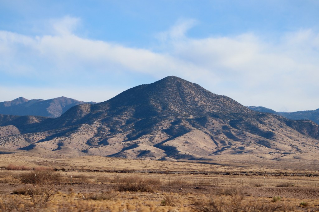
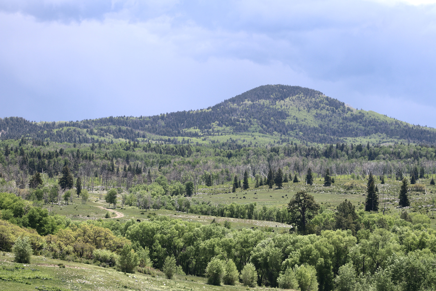
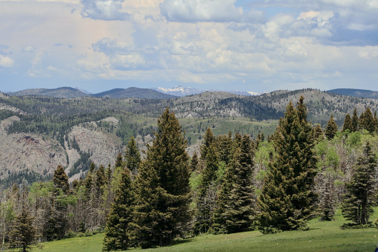
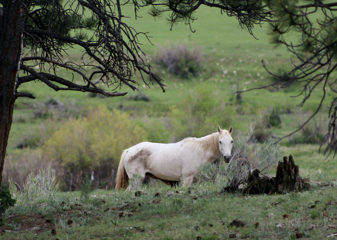
Next, we were on the road again, on our way to Chaco Culture National Historical Park. While New Mexico is a southern state, cold snowy days are not uncommon for it. It was snowing that afternoon and for awhile, all we could see was vast fields of land covered by thin layers of frost against the pale grayish sky. Infrequently, we would notice half-a-dozen of horses, indicating the presence of small farms. I thought then – the quality of being difficult to cultivate served well to the spirit of that land. It has stayed nearly intact in spite of the twists of history that have taken place throughout the past few centuries.
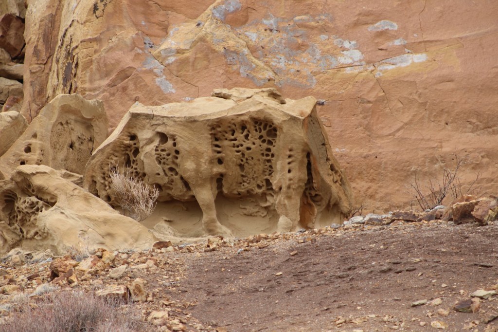
The scenery has slightly changed and we witnessed another marvel along the way – Bisti Wilderness Area, also known as the Bisti Badlands. The scenic view of curvy mounds and smoothly eroded rocks made me feel the rocks were alive. Devoid of tourist crowds, the place was living a life of its own. Some gems are to be seen only by the few and are better off if kept secret!
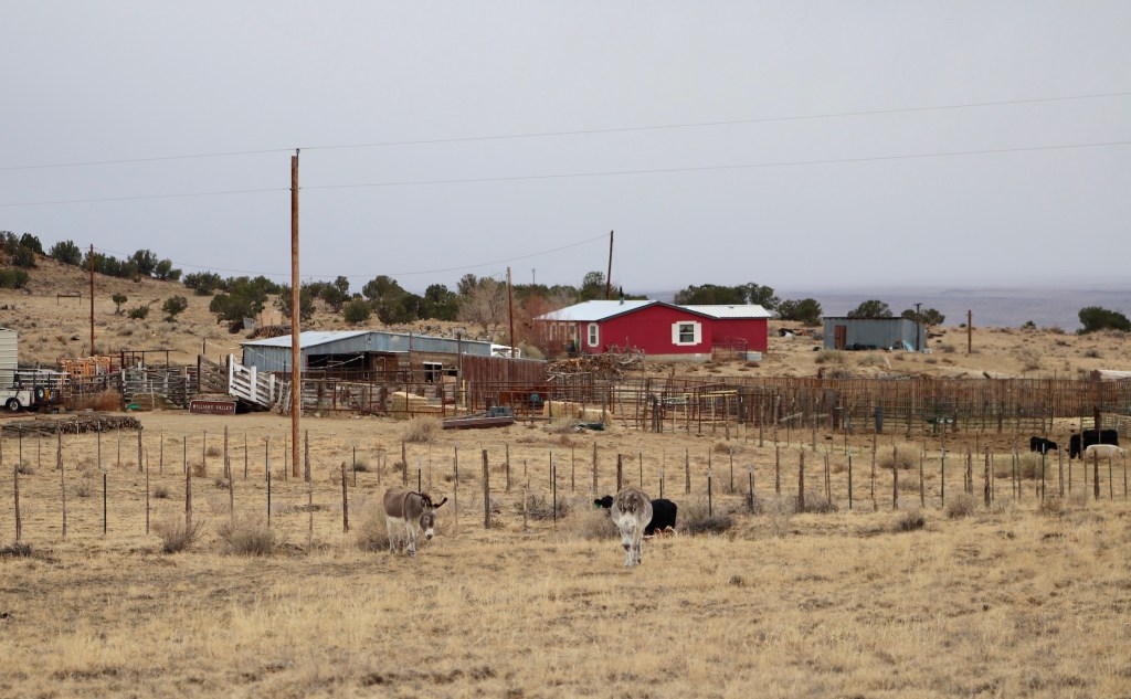
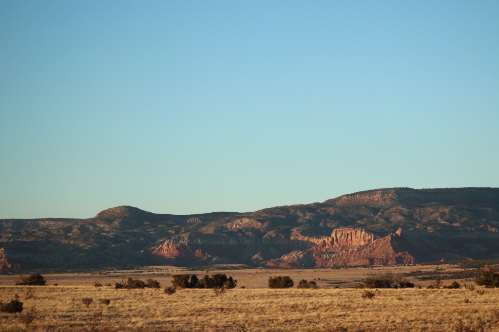
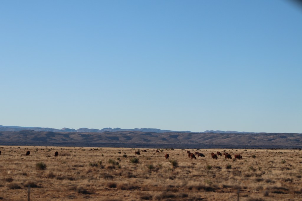
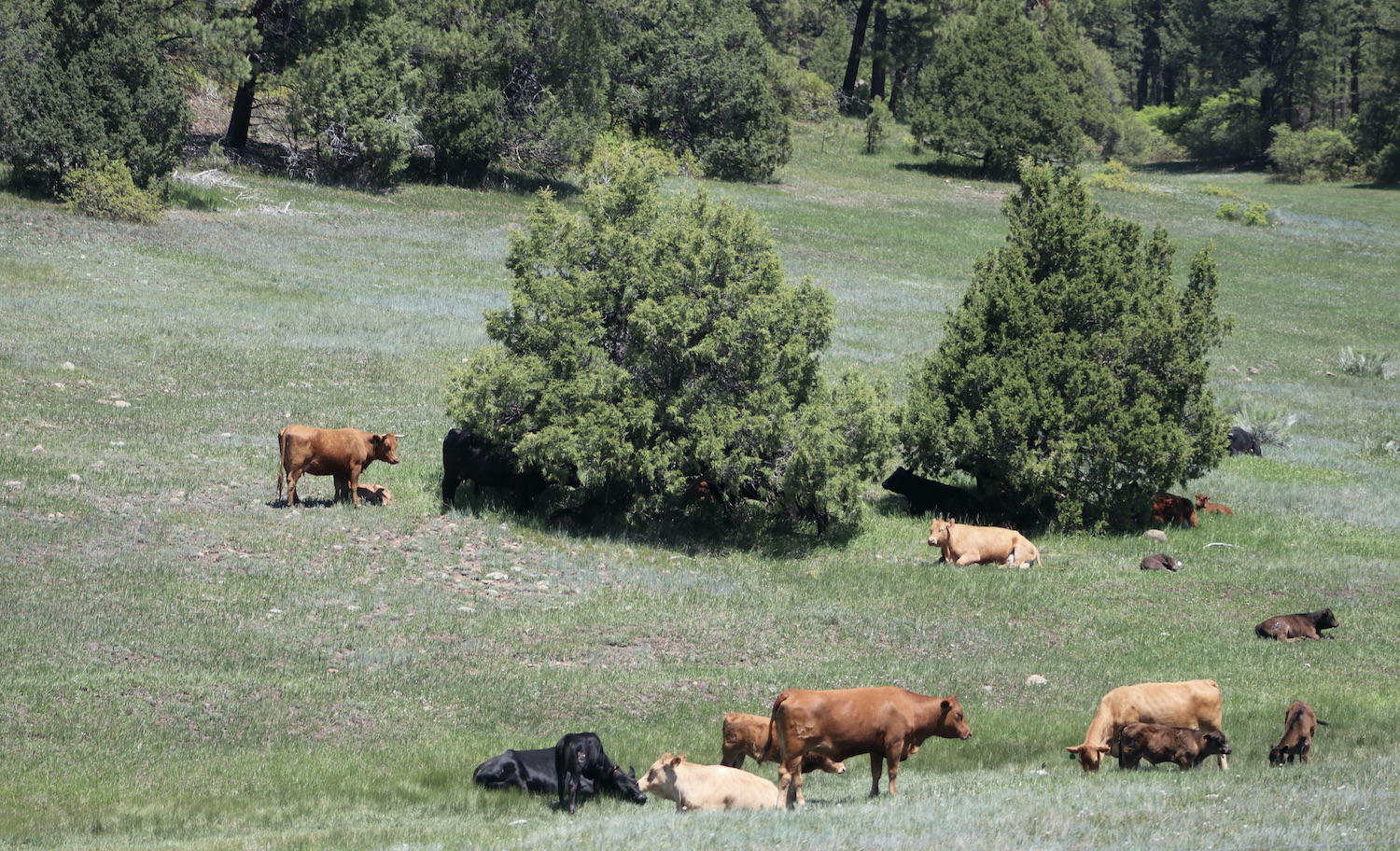
As we passed miles of uninhabited land, all of a sudden, the weather changed, and so did the landscape. A couple of lonely farms reminded us of human presence – the donkeys gazed meekly and the cows carelessly kept on munching the grass looking incuriously at us and exhibited the usual calmness. From the farms, we continued down the dirt-road toward Chaco Canyon. Everything turned sandy and reddish around us – we were approaching the ancient man-made landmark – a testament to the creative genius of the Ancestral Puebloan people. As the architectural remnants of massive stone buildings came into sight, I stared with fascination at heritage that survived from between 850-1250 A.D. The place was at once a major center of ancestral Puebloan culture – it was “a special gathering place where many peoples and clans converged to share their ceremonies, traditions, and knowledge”. While the intricate ways of life at that time are not yet fully understood, the ruins serve to demonstrate the complexity of the community life, including the high level of social organization, commerce, and cultural richness. Today, Southwestern Native people look upon Chaco as a spiritual place to be honored and respected.
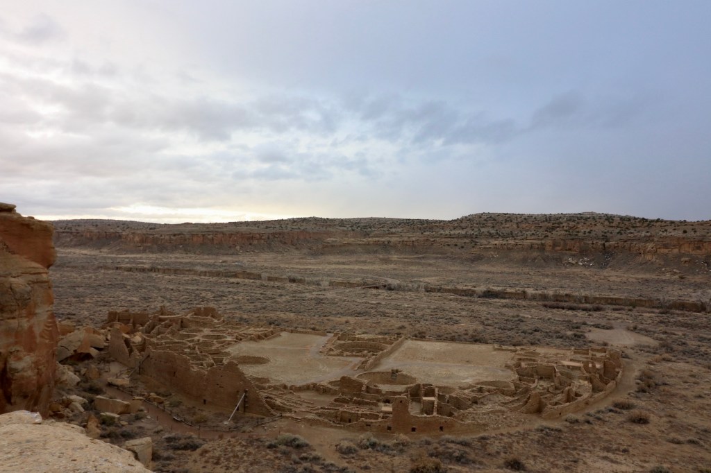
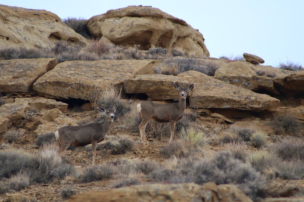
As the sun was hiding behind thin clouds the entire afternoon, the soft diffused light created a sense of stillness and timelessness. The landscape struck me with its harmonious spirit – the nature and ancient ruins were one and inseparable. The energy of the place was neutral and calm, with wildlife occasionally crossing my sight: timid deer disappearing behind the cliffs, or a raven surveying the land and checking up on any snack crumbs that strangers like us may have left behind.
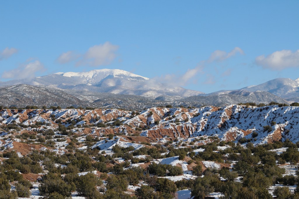
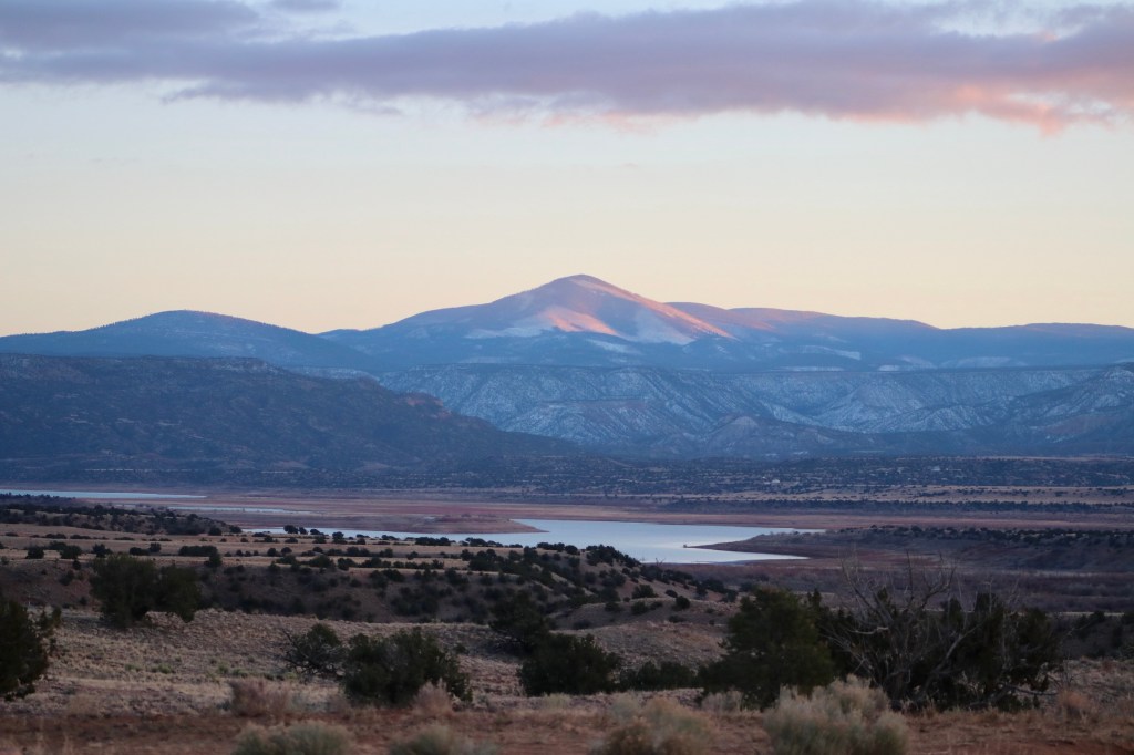
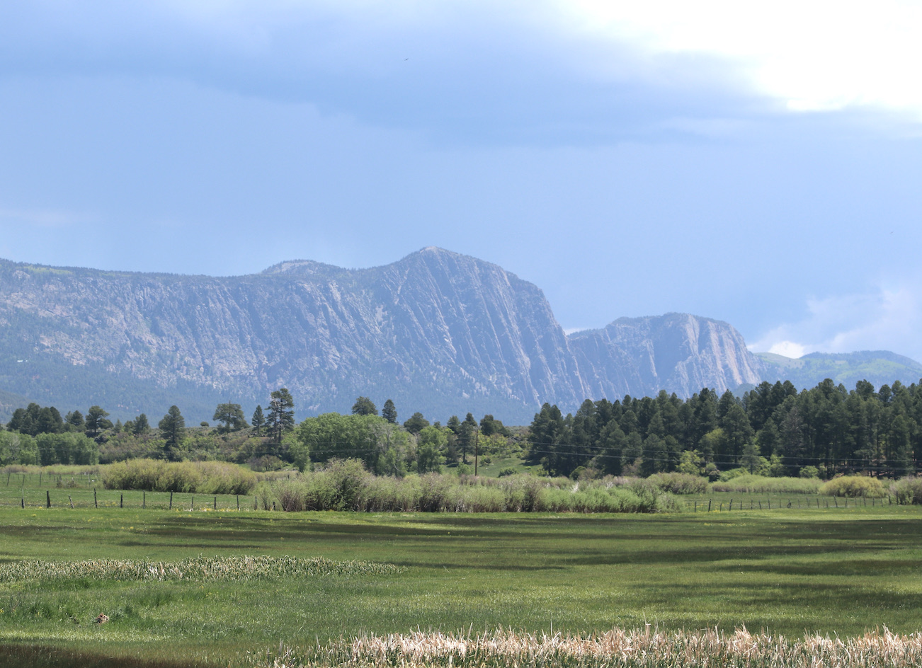
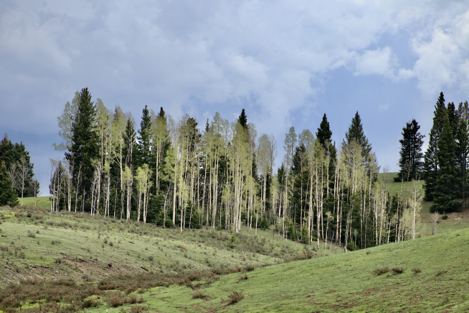
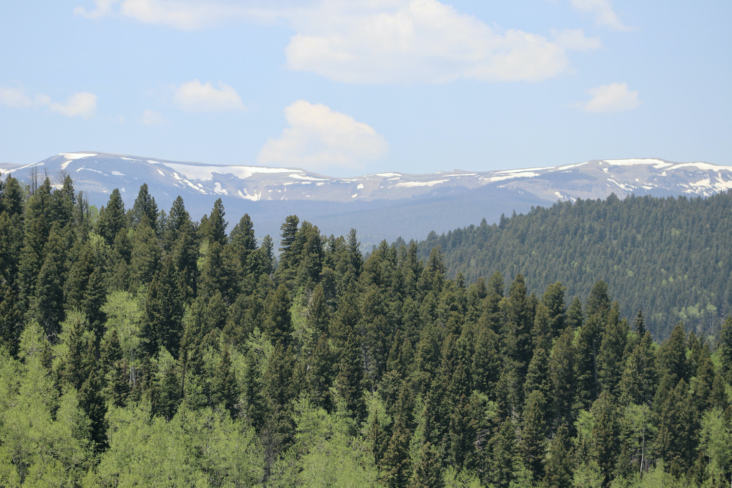
Next day truly made me remember that I was on the once land known as ‘the Old West’! We reached Santa Fe and continued north on US-84. What we witnessed along the half-hour ride was unexpected – as we gained elevation, stunning views of uneven rocky surface lightly powdered by snow opened up to us. Those ridges were the brims of Sangre de Cristo Mountains (southernmost sub-range of the Rocky Mountains). Under the glaring midday sun the landscape instilled a freedom so vast and inspiriting was the mountainous scenery.
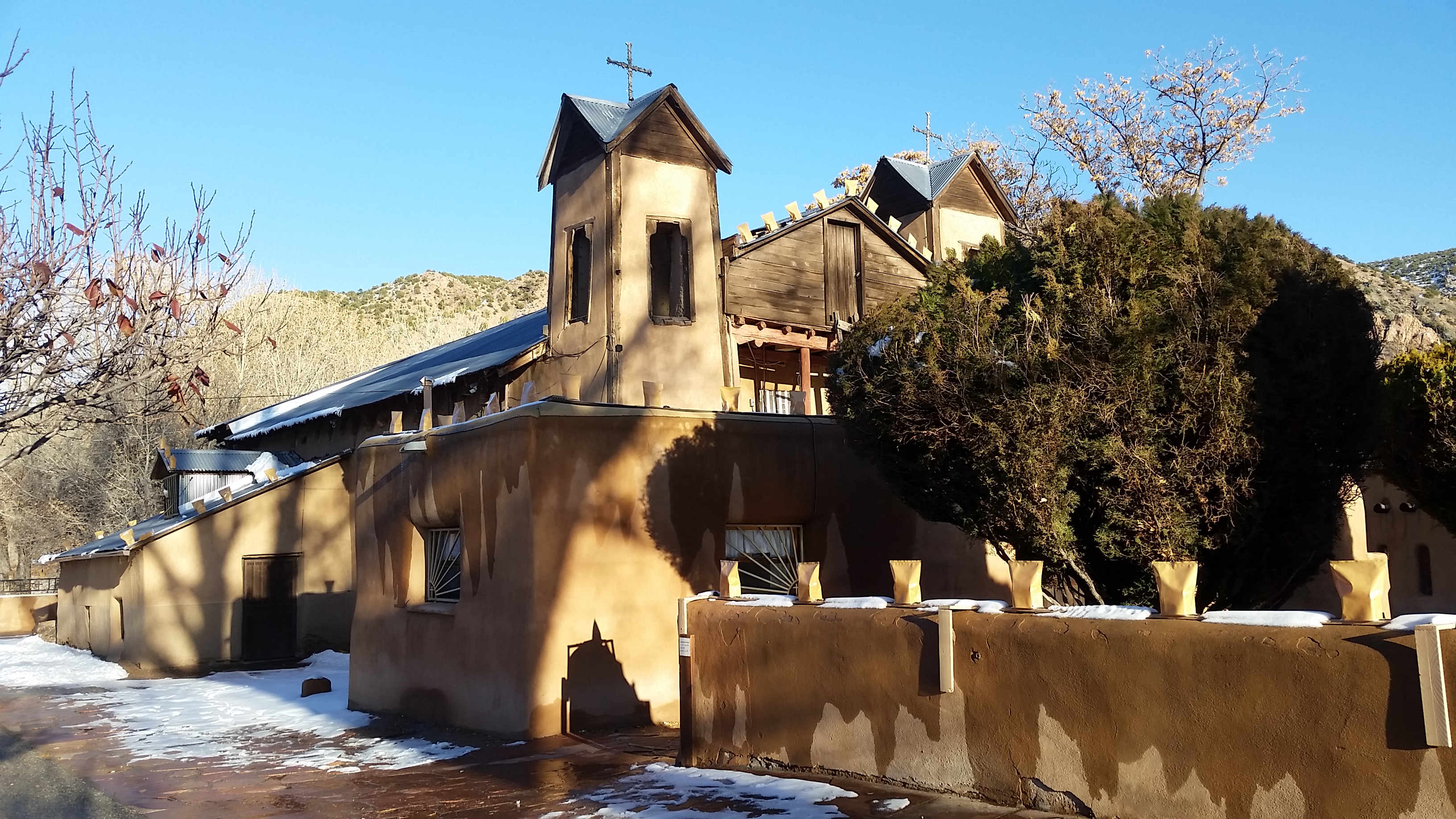
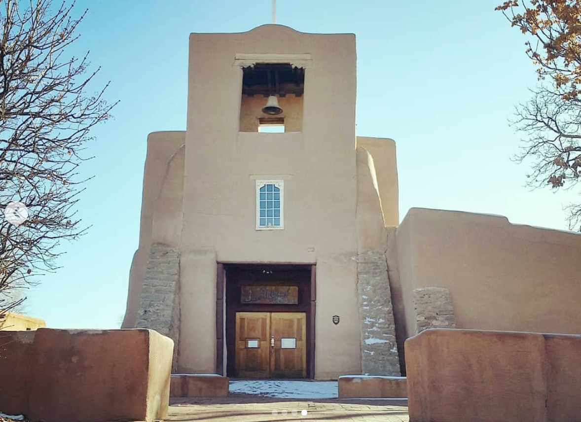
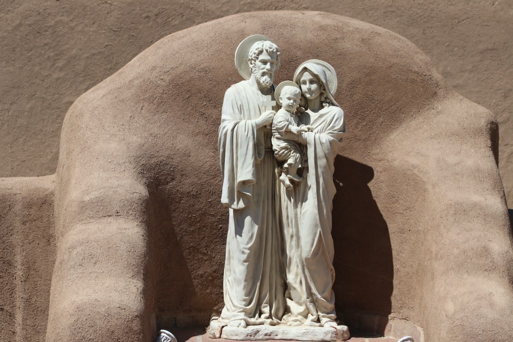
We continued on towards the town Chimayó and shortly reached a National Historic Landmark – the sanctuary ‘El Santuario de Chimayó – a adobe Roman Catholic church, a famous pilgrimage site.
Our next stop further north was the city of Española. The town didn’t seem to be a thriving one, with many buildings standing unused or abandoned. Yet, this place is a window into the intriguing socio-political history of New Mexico, so let’s glance into the past. <…When the land of Nuevo México was proclaimed a Kingdom of the Spanish Empire and New Spain in 1598, the small town of Española was founded as its capital (although from 1610 onward the capital was Santa Fe). XVII century was marked by major expeditions to these areas as the Spaniards were determined to discover cities of gold and, nearly as importantly, spread Catholicism throughout the land that had been inhabited by Native American people for hundreds of years. The invasion of this land wasn’t peaceful…Gradually, dozens of the Spanish missions were established and, while some turned out to be successful, local religions were being banished and tensions kept rising until the indigenous communities rebelled in the Pueblo Revolt of 1680. The Spanish were expelled from Nuevo México for a period of 12 years…and the pueblo people were able to regain lost lands. However, the Spanish reoccupied Santa Fe in 1692 and the rule of New Spain was re-established and remained until Mexico’s declaration of independence in 1821. At that time, the land was proclaimed the Territory of New Mexico. Later, at the end of the Mexican–American War, Mexico recognized its loss to the United States in 1848 and eventually, New Mexico became one of the US states in 1912...>
What a whirlwind of events that changed and inevitably shaped the course of people’s life on this land! History aside, the town was not too impressive and we were off to our next destination.
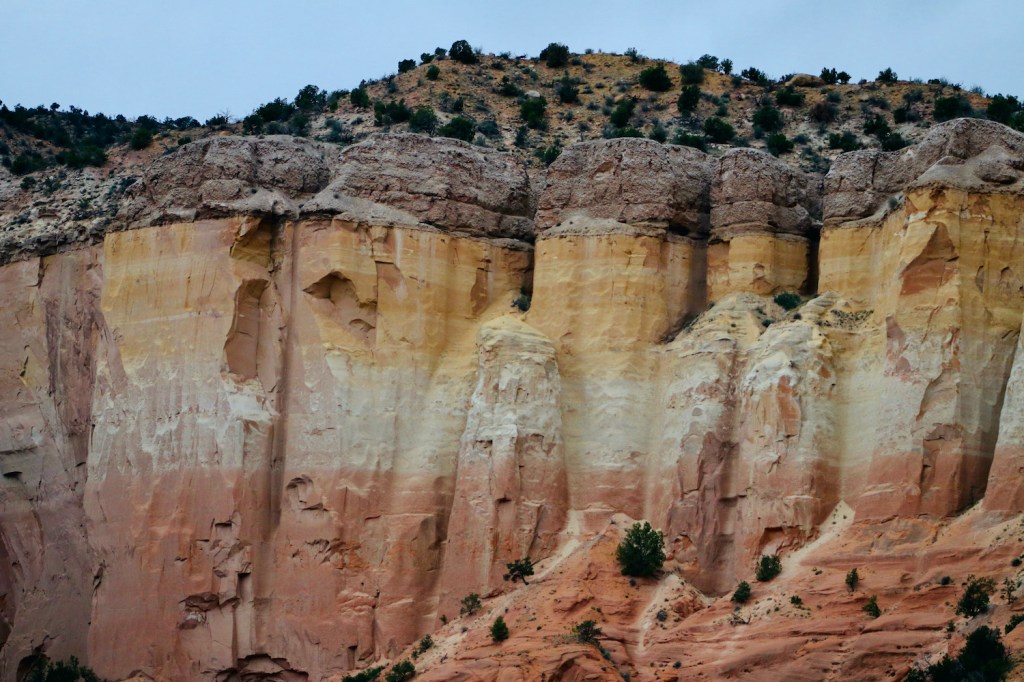
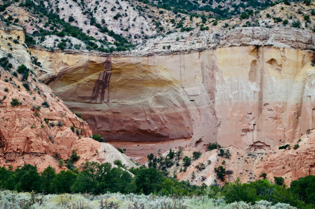
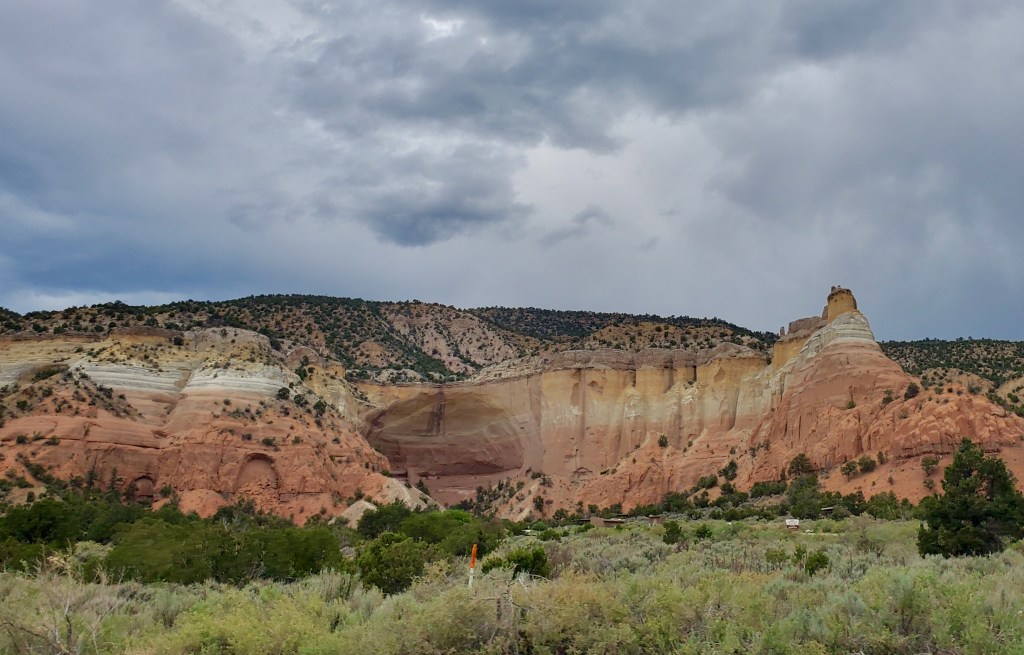
We continued up North via the picturesque route toward the mysterious Ghost Ranch near the village of Abiquiú. We were welcomed with the views of the Rito del Yeso stream that meandered through the canyons and gorge; the place seemed slightly otherworldly, as the shades of purple touched the landscape at sunset. While the site is known for a remarkable concentration of prehistoric fossils, it gained more more notice in the past century as it was the home and studio of Georgia O’Keeffe (1887 – 1986), as well as the subject of many of her paintings. Two of the artist’s works are below: “Pedernal” and “Ghost Ranch Cliffs” – both are illustrating local surroundings.
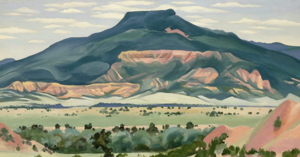
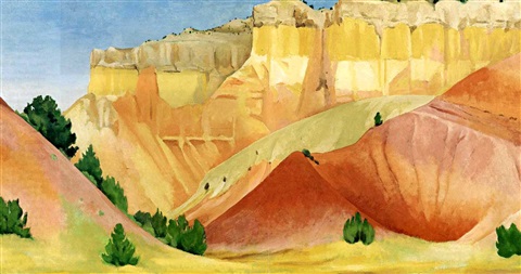
It is no wonder that the majestic varicolored cliffs and mounts consistently inspired the artist. This landscape, with its powerful energy and silent wisdom, wouldn’t leave anyone indifferent. The sense of timelessness and eagerness for grasping the reality may quiver in your heart and make you feel overpowered as you gaze at the still ensemble of colors, patterns, and intricately carved shapes but, a second later you become capable of simply being in the moment. The concept of ‘I am here’ is becoming vague, the concept of ‘now’ is noting but a phantom, the concept of ‘I am’ is the only one you may hold on to.
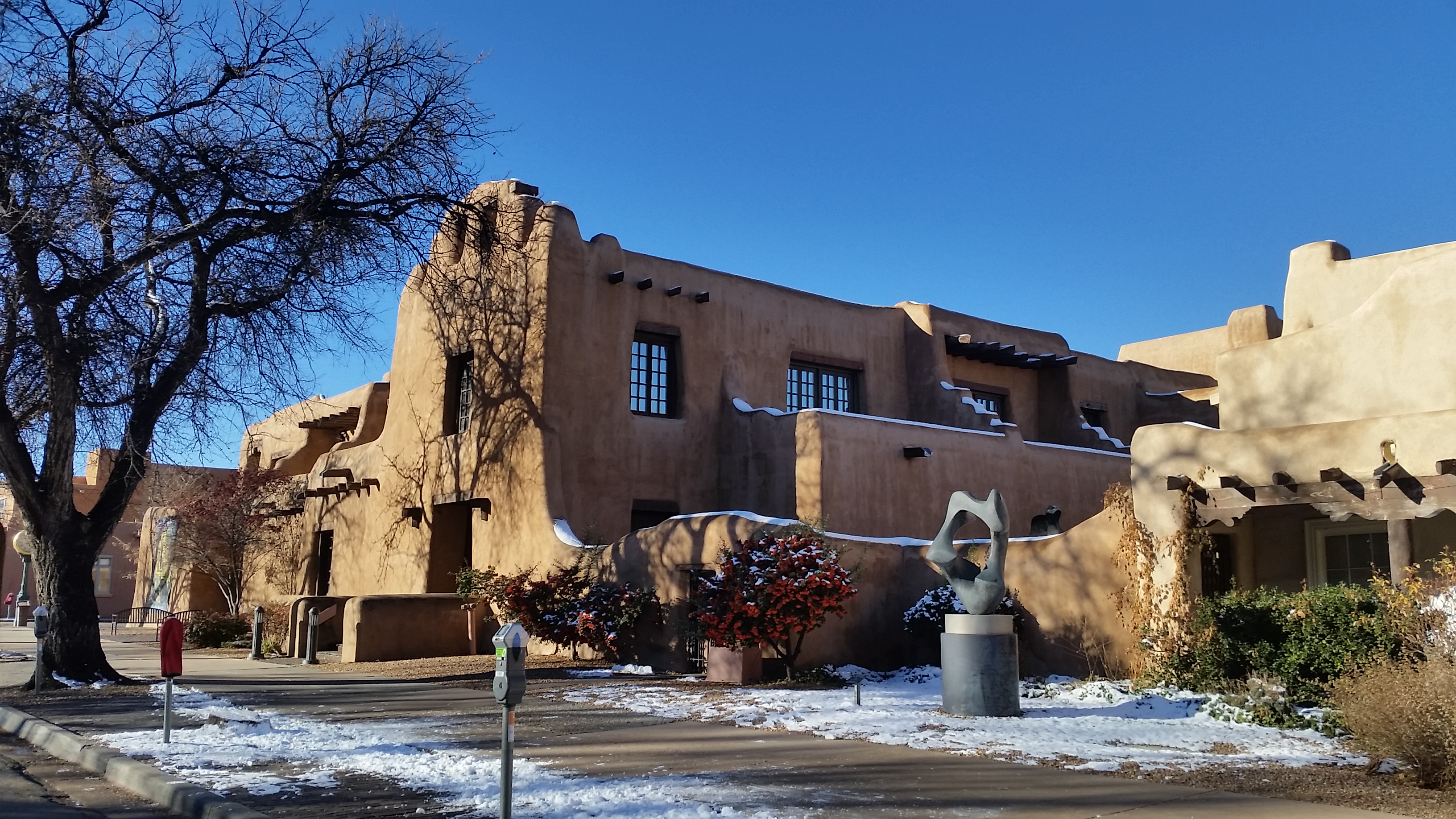
On a bright November morning of the following day we had a chance to saunter along the quiet streets of Santa Fe historic core. Perhaps, such spontaneous explorative walks are the best way to make the acquaintance of any unfamiliar city: you ought to be looking for nothing to let a town’s fabric tell its story. The stuccoed adobe buildings are painted in earth tones and mirror the traditional Pueblo architecture and the Spanish mission style by featuring rounded corners, stepped massing, and thick, battered walls. In fact the entire Old Santa Fe is built in a so-called Pueblo-Spanish style, so wherever your gaze has landed, you will find the past is subtly and organically interwoven with the present in this city.
Yet, it was time to travel back to Albuquerque. On our way, we passed a tiny town of Madrid – a former coal mining place, it has subsequently turned into an artist and hippie community. Historic buildings, many of which are painted up in playful colors, function as small galleries where local makers show off their work in a variety of mediums. We kept stopping on the roadside to enjoy the views of the valleys and take in the creative atmosphere that the landscape was so abundant with. It is no wonder artists fall in love with New Mexico! The inspiration can be found in so many corners of this unique and picturesque land.
Part II: SOUTH
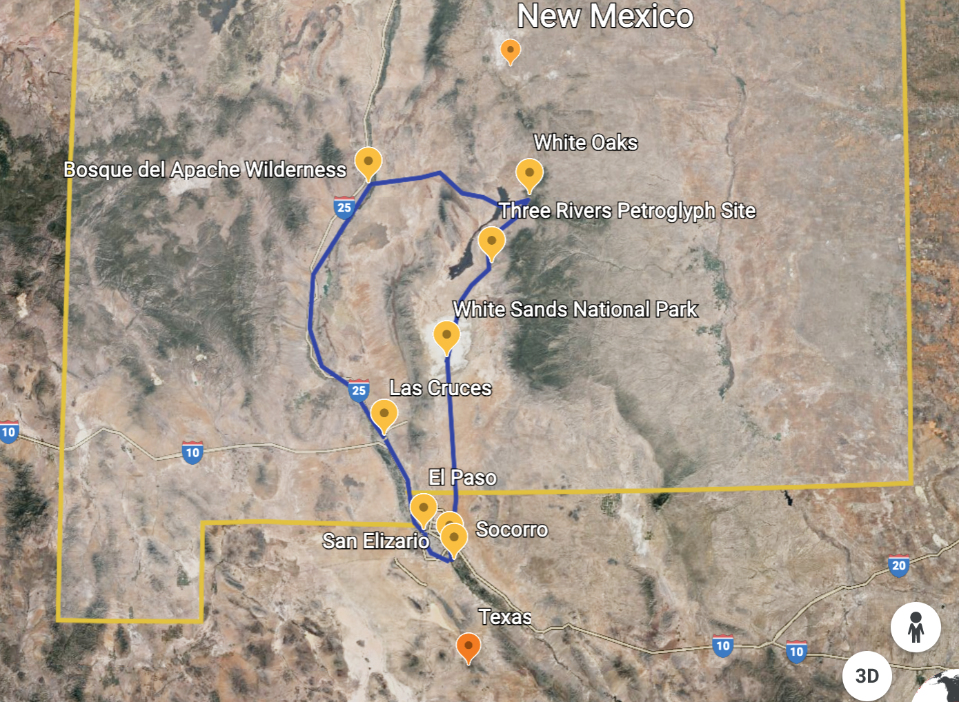
The southern New Mexico has yet more cultural and natural gems to explore. We started with a tour of the local historic and architectural heritage. Having landed in El Paso, Texas (just few miles away from New Mexico border), we took a road known as El Camino Real de Tierra Adentro (Royal Road of the Interior Land). During and after the Spanish colonial era (1598 – 1882), this road was a 2,560-kilometre-long trade route between Mexico City, Mexico and San Juan Pueblo in Santa Fe, New Mexico. It was the northernmost of the four major “royal roads” that linked Mexico City to its major tributaries. The 650 km section of the route within the United States is now the National Historic Trail.
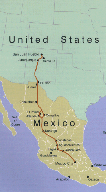
Prior to the arrival of the Spanish, North American tribes traveled the trails that would become El Camino Real de Tierra Adentro. Tribes in what is now New Mexico traded such items as buffalo hides from the Plains, salt, slaves, pigments, and turquoise. Groups from the south brought goods such as copper bells, chocolate, marine shells, and live macaws.
In 1598, with the assistance of Native guides, a Spaniard Don Juan de Oñate, led a group up what would become El Camino Real de Tierra Adentro and started the official Spanish settlement of New Mexico. Over the next 300 years the 1,600-mile route brought settlers, traders, and soldiers from Veracruz, inland through Mexico City, north to Chihuahua, through present-day El Paso, to Socorro, Albuquerque, and, after its founding in 1610, to Santa Fe The Camino Real was actively used as a commercial route, mainly for the transport of silver extracted from northern mines. During this time, the road was continuously improved, and over time the risks became smaller as haciendas and population centers emerged. Until the arrival of the railroad, the railroad continued to thrive.By foot, hoof, and rail, the trail forever linked the history and peoples of Spain, Mexico, and the United States. (newmexicoculture.org, whc.unesco.org).
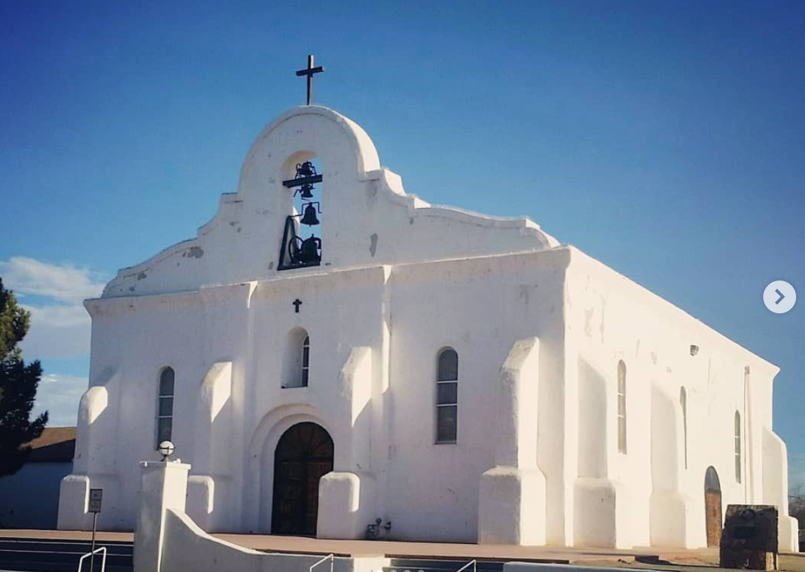
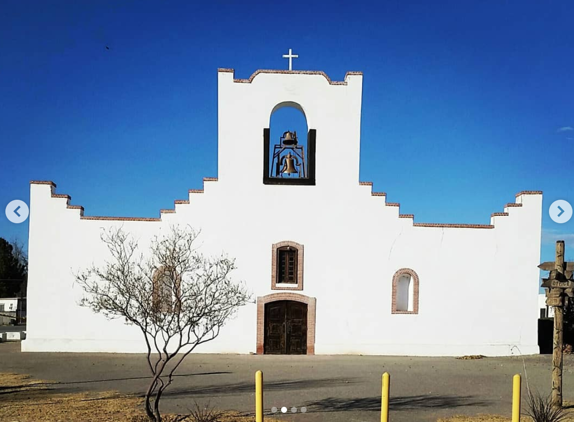
The town of San Elizario was one of the very first Spanish colonial villages, founded by conquistador de Oñate who led a group of colonists from southern Chihuahua to settle here and claimed the new province for King Philip II of Spain. Today, this small town is considered to be the “Birth of the American Southwest”.
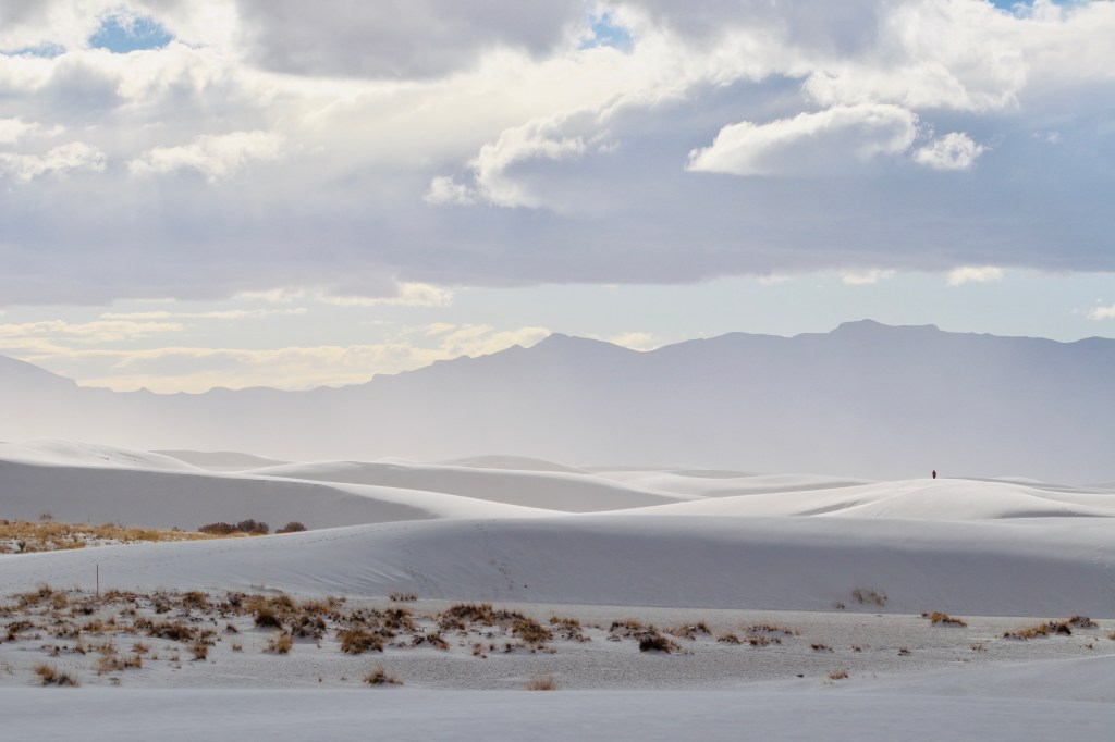
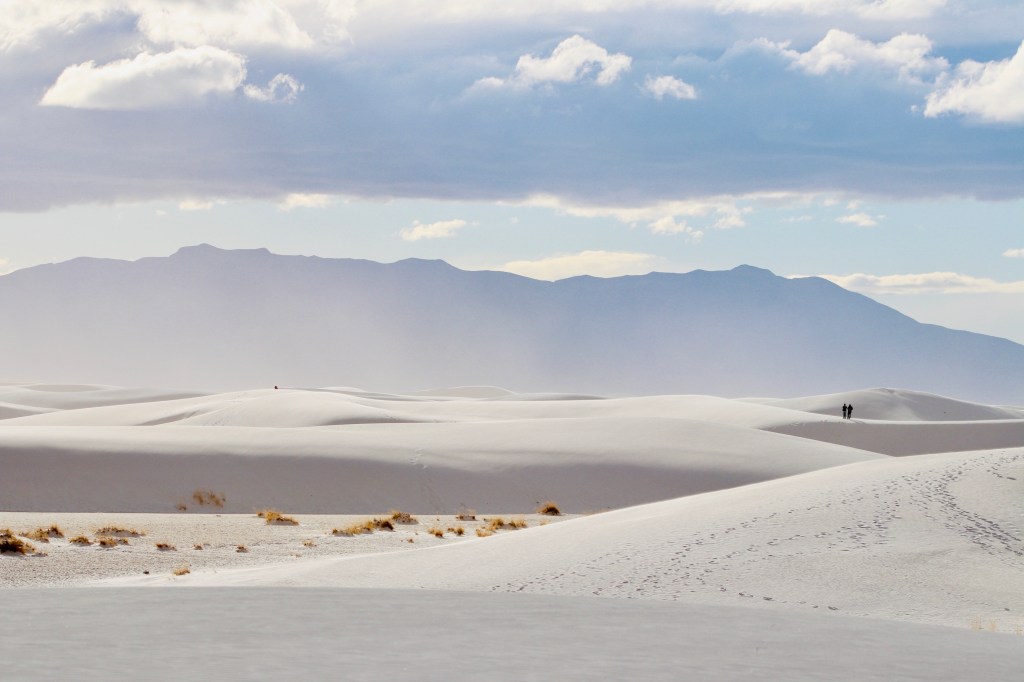
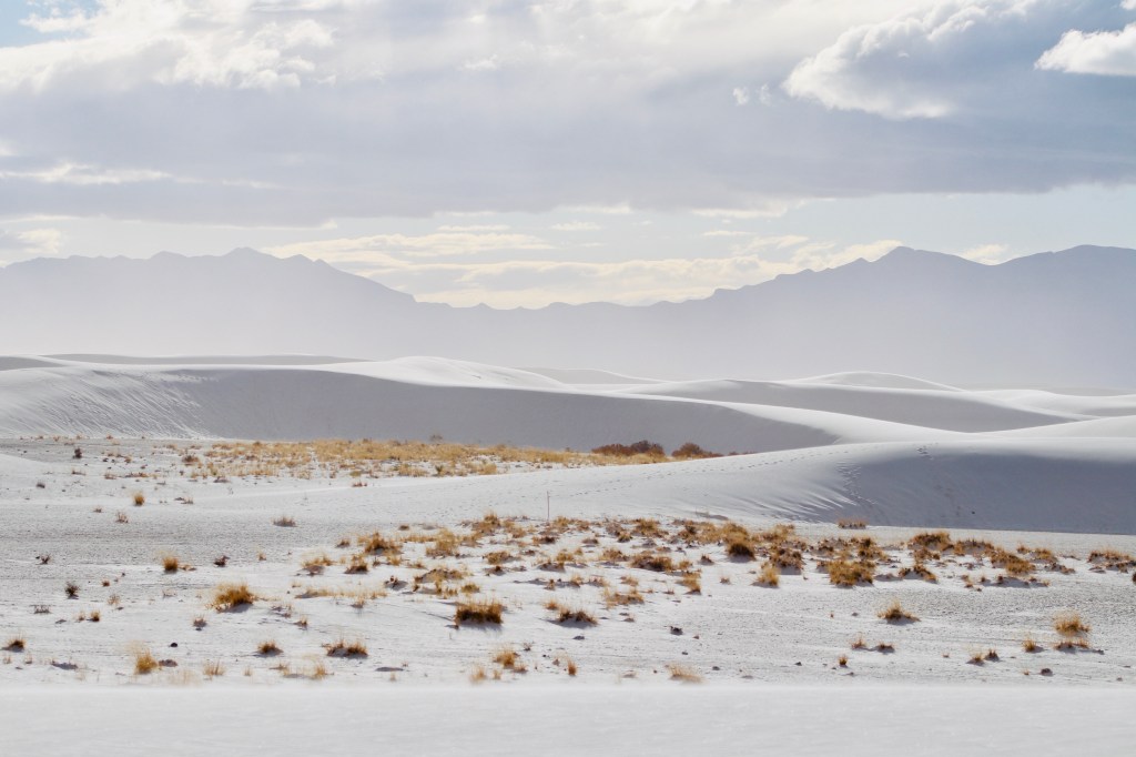
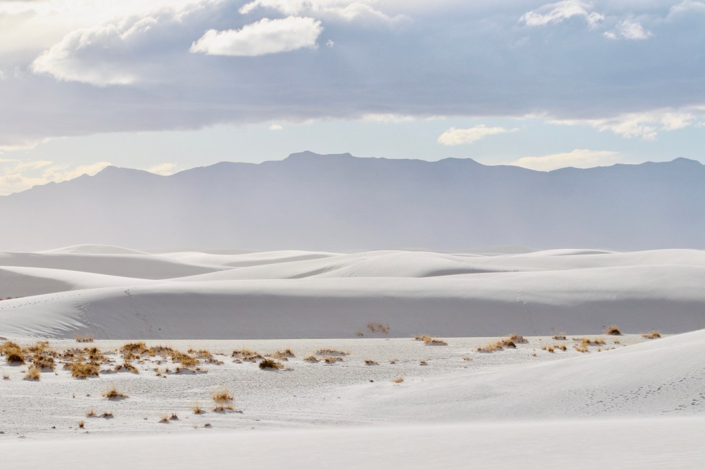
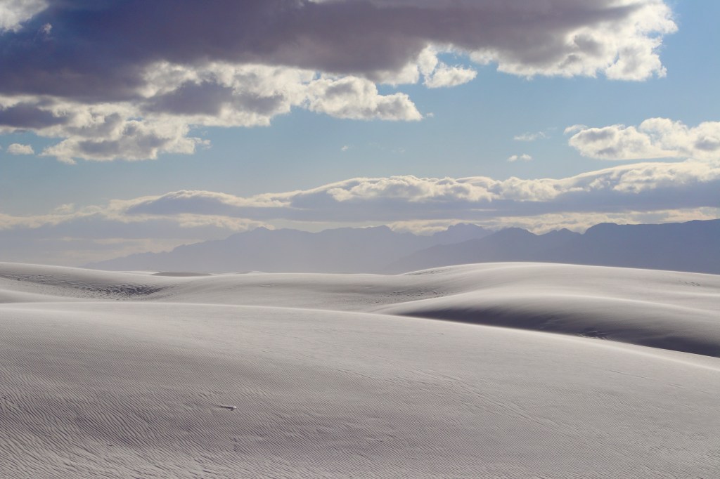
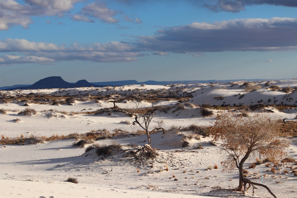
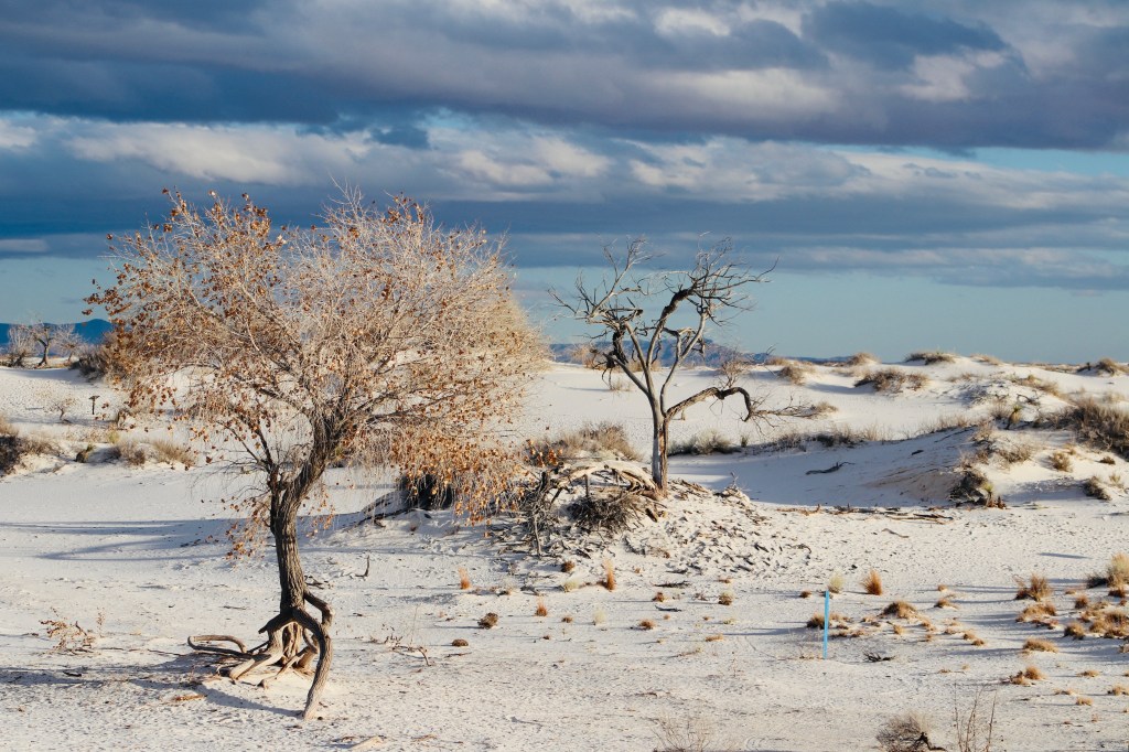
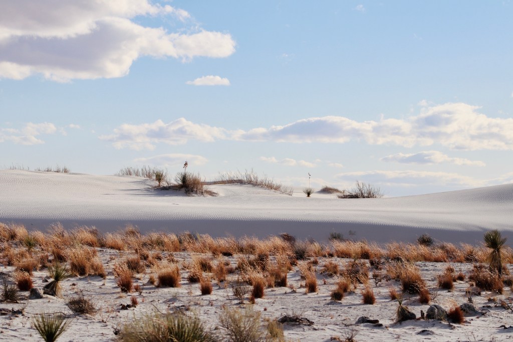
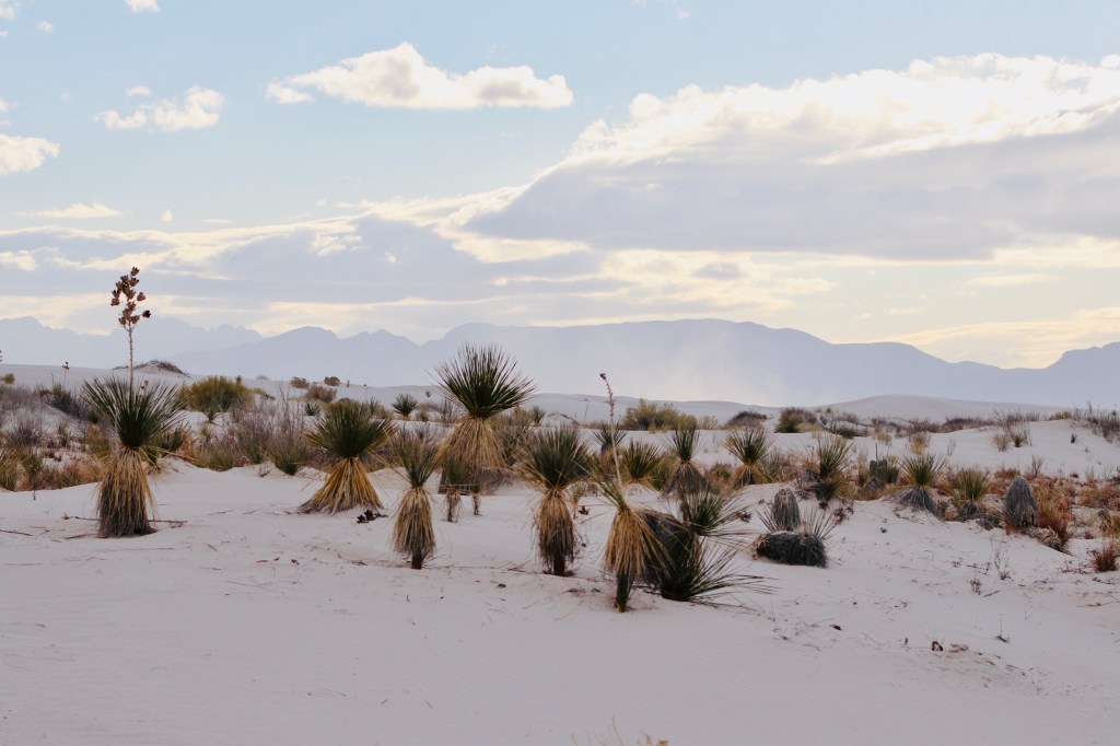
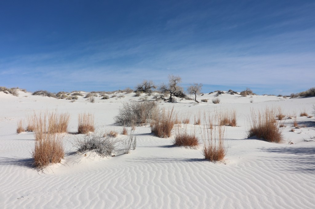
Much as I like exploring architecture, I was happy to switch gears and delve into the uniquely beautiful nature concealed within look and feel of the sight or the intricate way it came to be so. What you raise your eyes to upon entrance is a white ocean – an ocean of white weightless sand that is constantly moving and changing shapes. You are in the White Sands National Park. As though you are on another planet, you are looking at what you couldn’t have imagined before.
Covering the Tularosa Basin, the vast field of white sand dunes is composed of gypsum crystals. Millions of years ago there were shallow seas that dried up and left behind gypsum. Over time, rivers carried gypsum to the large lakes in Tularosa Basin. As the lakes were drying up, selenite crystals were formed on the surface. Strong winds broke up the crystals and carried them eastward, forming the dunes as we see them now. A similar process continues to produce gypsum sand today.
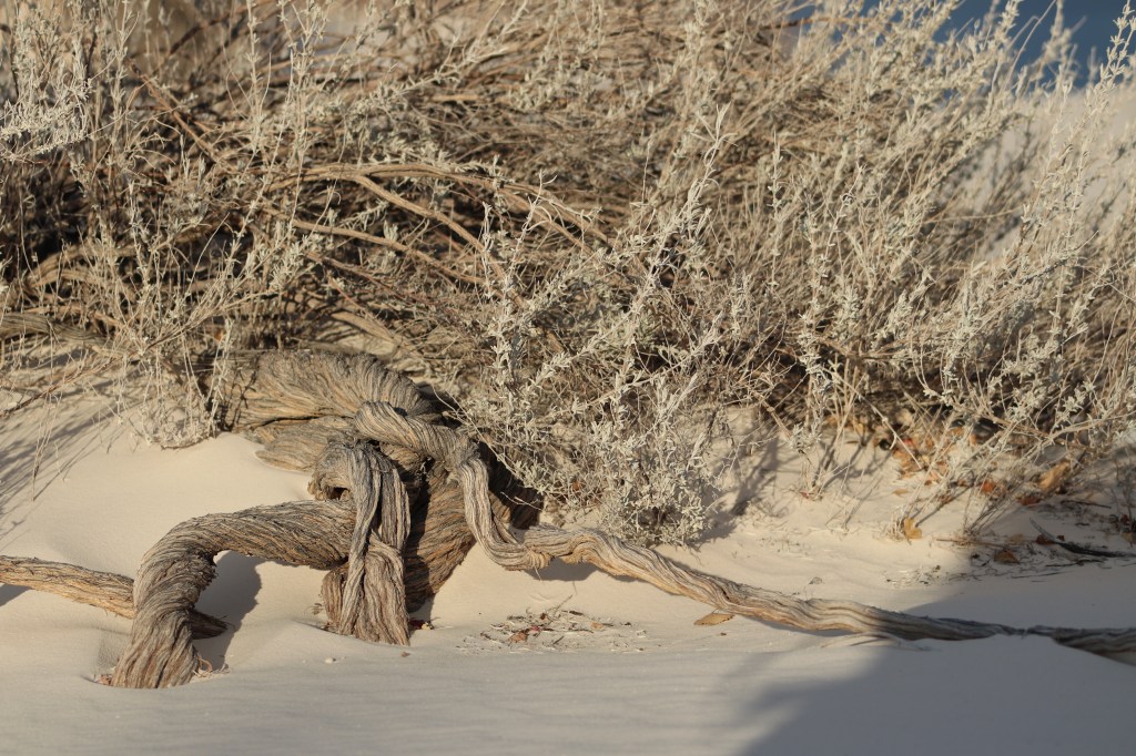
Life forms in White Sands are elusive and unique. Lizards, rodents, beetles – I have seen none of the resident critters, but the traces were all over the surface of the white ocean. The crowned yucca plants and cottonwood trees will serve you as marks in the maze infinite maze that you will be lured walk. What you will not want to miss is laying down by the giant Cottonwood tree when light breeze is running through the dry leaves and enacting the gentle yet lively clapping sound that will evoke a sense of peace you might have experienced sometime in infancy or even before you were born.
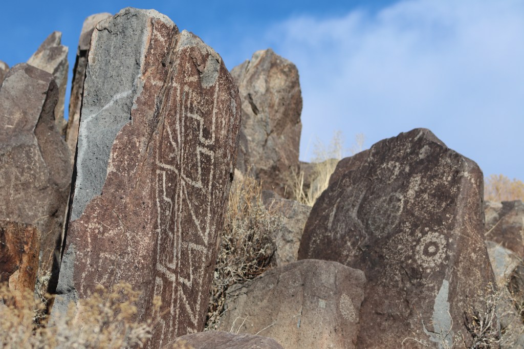
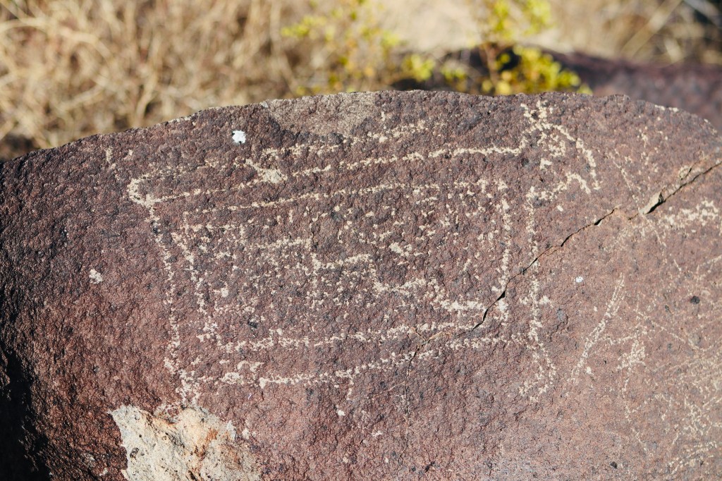
Having been reawakened by the wonder of nature, we went on exploring and reached the next sight – the Three Rivers Petroglyph Site that features outstanding examples of prehistoric Jornada Mogollon rock art that dates back to 900 – 1400 AD. With Sierra Blanca towering above the rocks, the narrow path invites you to peer through the veil of time and ponder about the hidden messages embedded in the symbols. Being face to face with the relics of ages long gone by may even feel uncanny as you are a guest here in the realm of past. Be not deceived by seemingly primitive designs – you won’t be able to decipher messages, unless you are an archeological guru. Yet, your imagination will be likely to do you a favor by creating spooky interpretations of cryptic drawings.
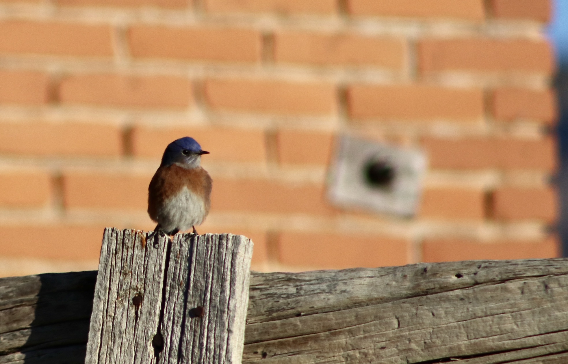
Next, having passed few miles down Hwy 54 and reached the “ghost town” of White Oaks, we leaped into the late 19th century – a historic era that revolved around the discovery of gold and coal in the nearby mountains. In White Oaks, you can see the surroundings with cowboy’s eyes. White Oaks died with the expansion of railroads and exhaustion of gold mines. Several historic buildings including the Saloon, Schoolhouse and goal-mine owner’s Victorian mansion still stand, creating the image of the frontier town that rapidly boomed and just as rapidly turned into the shadow of itself by the turn of the century.
Eastern Bluebird is the current most populous resident of the town:
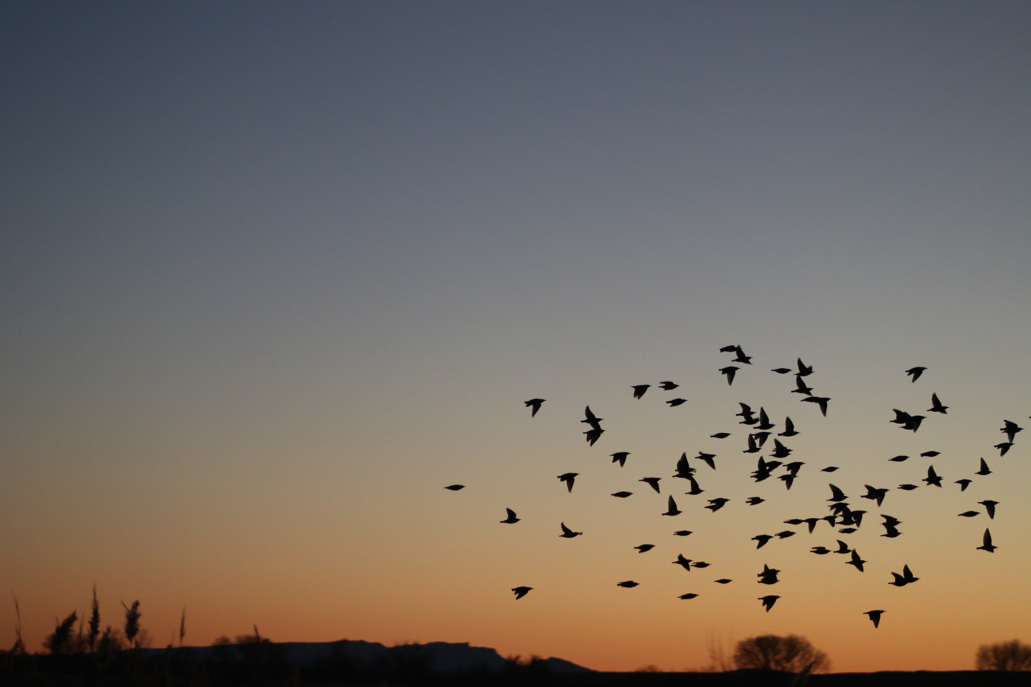
What could a traveler long for after an excursion through the loops of history and prehistory? Just another sight of nature, such as Bosque Del Apache National Wildlife Refuge. As we drove down the scenic US-380 route, the sunlit landscap was all ours. Burnt sienna and emerald-green knitted together by threads of gold. What else can we ask for so long as the road keeps winding through centuries old landscapes that are as intact as they must have been at their very inception… Nonetheless, we reached the refuge nearly at twilight. This was fortunate because we witnessed flocks of birds soaring against marigold-colored sky and gliding across the watershed on their way home. Right after the darkness set in, a heard of peccaries came into sight and disappeared behind the shrubs. It was about time we turned back to get some rest – we were back on the road, heading to the town of Las Cruses.
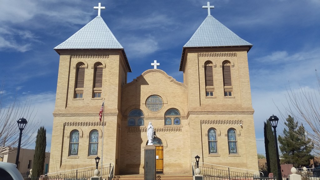
When you only have no more than 2 hours in a new town, you can fully let spontaneity to lead your walk and build an impression that is uniquely yours. Your emotional state of being is entwined with the soul of the town during those 2 hours of impromptu exploratory walks that create mental images of towns that are akin to memories of dreams. Las Cruses had an inviting atmosphere of a small town that still retained traces of the past while having been rebuilt to fit the needs of a modern community. Only later did I discover that the city went through a large urban renewal project, largely focused on improving throughfare. The sound of bells ringing atop the Basilica of San Albino, the cleanliness and quietness of a cozy small plaza, streets full of small shops and art galleries. Small buildings remodeled with care and retaining vernacular features, prompting you to slow down and be immersed in a quiet flow. Yet, it was about time were back on the road again!
Our next stop was the New Mexico Farm and Ranch Heritage Museum, which was closed that day, but, who said it wasn’t permitted to climb atop the fence, see the farm equipment, recreated structures and, most importantly, say hi to grazing calves and bow to a bull who seemed to own the ground of the museum and beyond. Indeed, this gave an excellent start to the new year of 2021!
Part III: NORTH
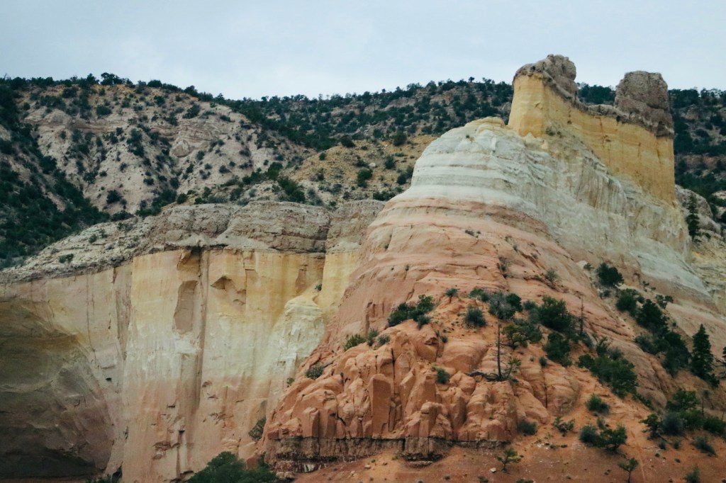
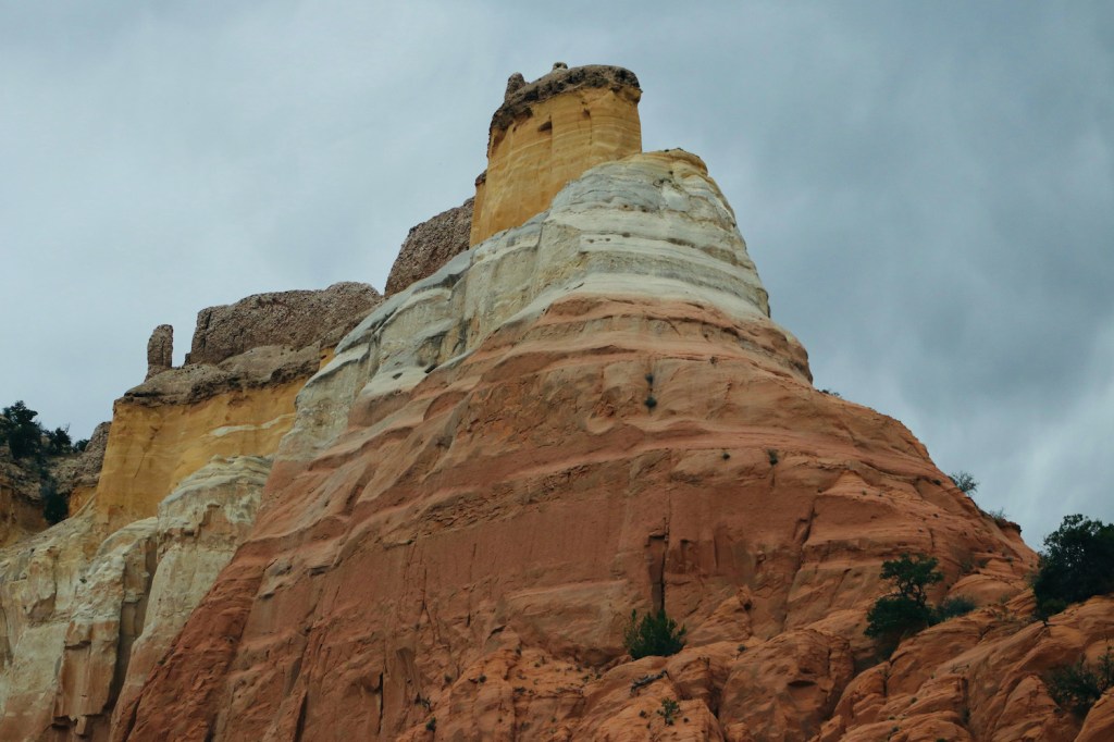
We reached the familiar town of Española by mid-afternoon. When in Espanola, expect to travel back in time if you pause and look around. We passed the Ghost ranch again and went on toward our first destination – Echo Amphitheater – a natural amphitheater located in the Carson National Forest. The sandstone cliff is horizontally stratified and has a large cave that has been carved by water cascading over cliffs over time. This geological wonder is also known for its unique echoing auditory properties. You will find it difficult leaving this site – as though a piece of symphony froze in front of your eyes and call for your attentions, so be heedful and perceive the sounds.
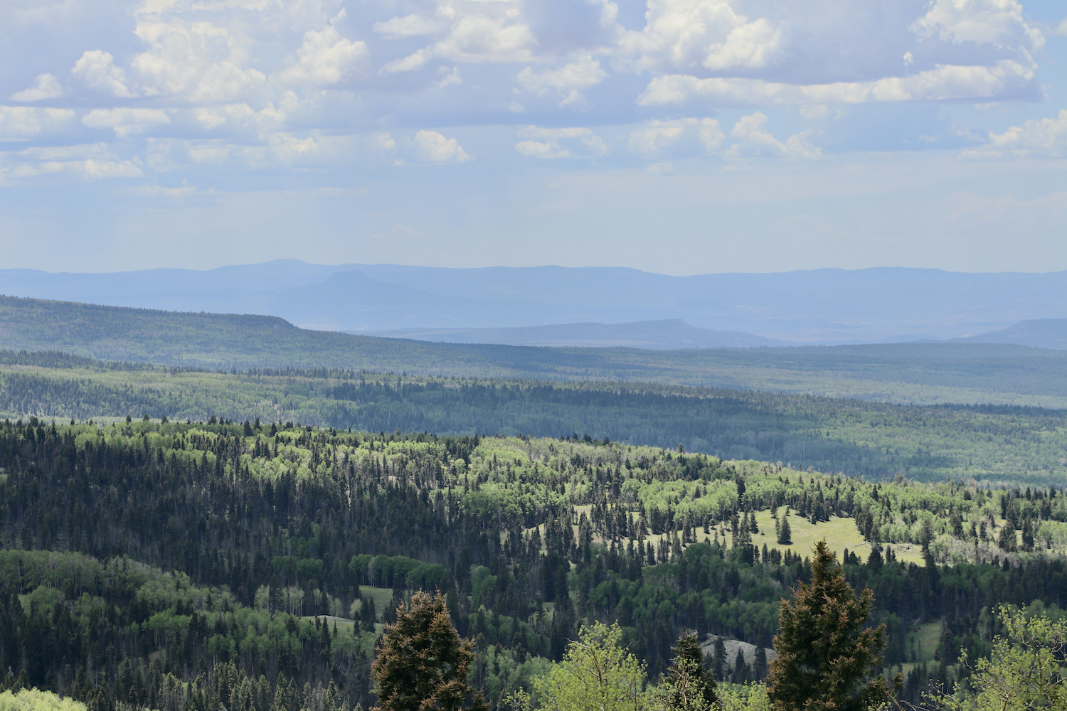
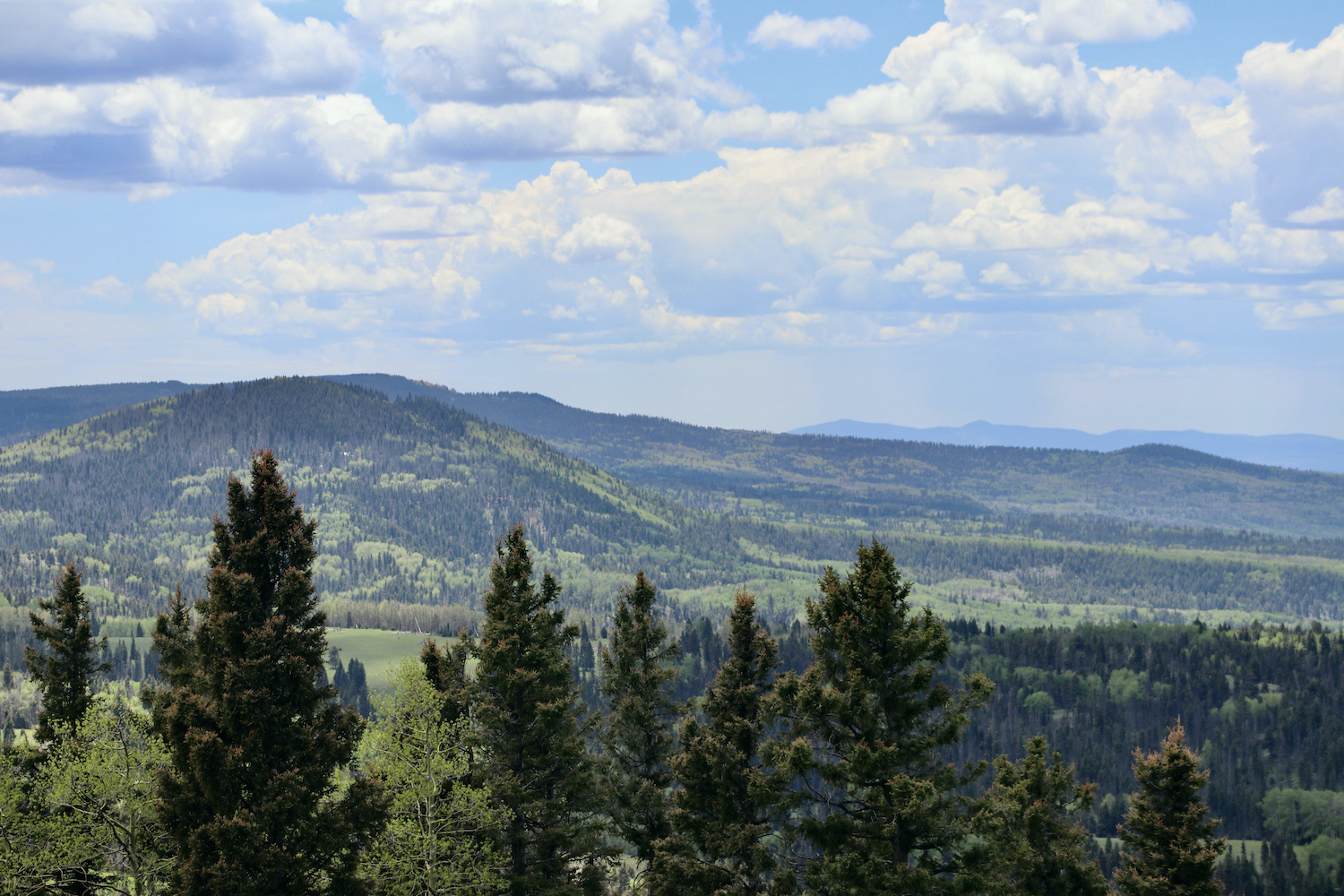
We arrived at the Brazos ranch by the dusk. Next morning, we went on to explore the Brazos Cliffs, which are made up of some of the oldest rock found in New Mexico (dating back 1.8 billion years). Morning haze added lightness to the gray surface of a ragged giant, and we kept stopping to admire the view. Continuing to the east, on the way to Taos, we drove through the Carson National Forest on U.S. Route 64 that was filled with spectacular views of mountains, meadows, and pastures. The road belongs to the Trail of the Ancients Byway that leads to prehistoric archaeological and geological sites of northwestern New Mexico and provides insight into the lives of the Native peoples.
A short detour took us past the village of Eagle Nest. The views of the Sangre de Cristo Mountains and pastoral landscapes along the winding route kept us mesmerized till we reached Taos after dark.
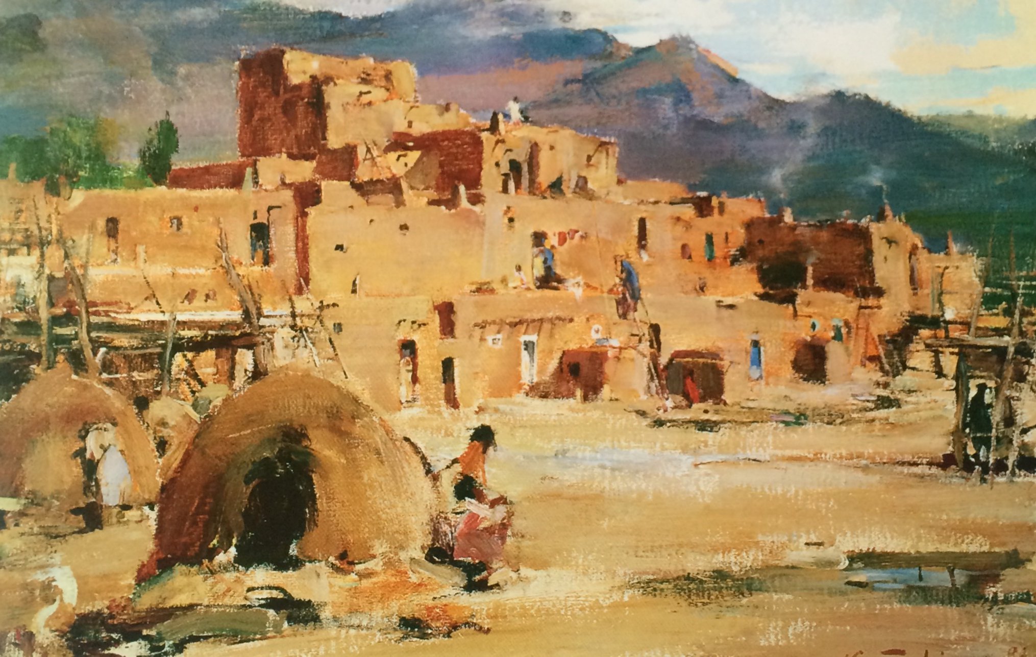
Taos is a tiny city, located near a tributary valley off the Rio Grande. The greater region is considered to be one of the oldest continuously inhabited communities in the US as the pueblo people have lived here nearly for millennium, which is exemplified by a well-preserved landmark – Taos Pueblo dwelling site. Unfortunately, Taos Pueblo was closed for tourist during our visit. The landmark has often been a subject of numerous artists’ paintings; one of such art-works is “the Taos Pueblo”(c.1920-30) by Nicolai Fechin (1881-1955).
The town of Taos was established in 1615, following the Spanish conquest of the Indian Pueblo villages. Initially, relations of the Spanish settlers with Taos Pueblo were amicable, but resentment of meddling by missionaries, and demands for tribute, led to a revolt in 1640. Taos Indians killed their priest and a number of Spanish settlers, and fled the pueblo, not returning until 1661. In 1680, Taos Pueblo joined the widespread Pueblo Revolt. After the Spanish Reconquest of 1692, Taos Pueblo continued armed resistance to the Spanish until 1696, when Governor Diego de Vargas defeated the Indians at Taos Canyon. Between 1796 and 1797 the Don Fernando de Taos Land Grant gave land to 63 Spanish families in the Taos valley. It was built as a fortified plaza with adobe buildings and is now a central plaza surrounded by residential areas. Mexico ceded the region to the U.S. in the Treaty of Guadalupe Hidalgo in 1848 after the Mexican–American War. After the U.S. takeover of New Mexico in 1847, Hispanics and American Indians in Taos staged a rebellion, known as the Taos Revolt, in which the newly appointed U.S. Governor, Charles Bent, was killed. New Mexico was a territory of the United States beginning 1850 and became a state in 1912.
Beginning in 1899, artists began to settle in Taos; In time, the Taos art colony developed. Some of the artists’ studios have been preserved and include the Nicolai Fechin house – the historic home of the Russian artist Nicolai Fechin (Николай Фешин). After purchasing the house in 1928, he spent several years enlarging and modifying the two-story adobe structure. He carved many of the fittings of the house and its furniture, using typical Russian design elements such as triptych windows and intricately carved doors. The whole reflects a modernist sensibility combined with Russian, Native American and Spanish traditions. The house is open for visits and features original paintings by the artist.
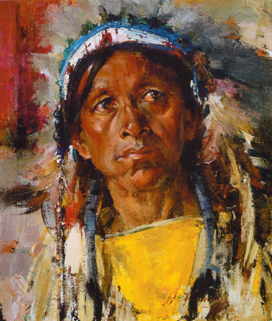
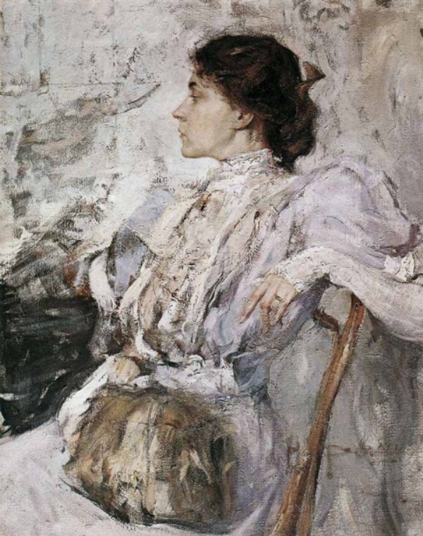
Some portraits by Fechin:


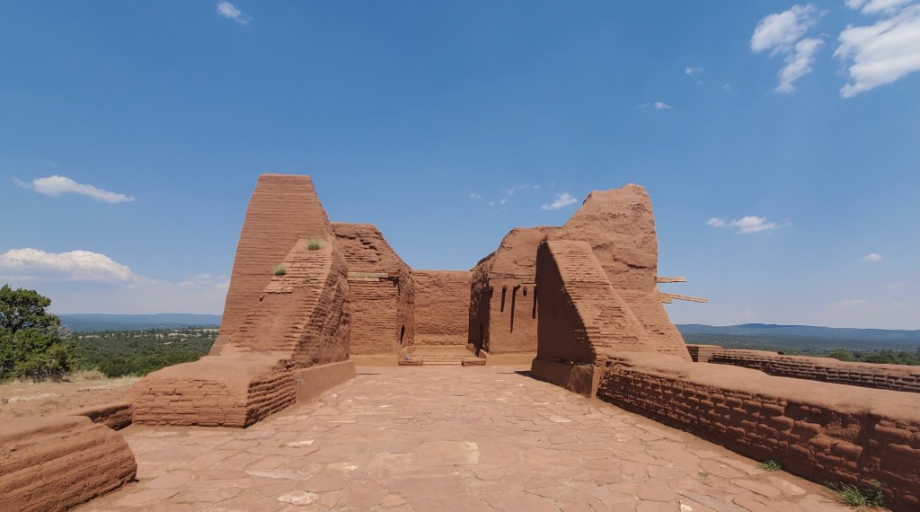
Our next stop was San Francisco de Asís Mission Church on the main plaza of Ranchos de Taos (originally the center of a small Mexican and Indian 18th Century agricultural community), built between 1772 and 1816 (the region was then subject to Spain). It was the center of the fortified plaza, which provided for protection against Comanche attacks. The church is a fine example of a New Mexico Spanish Colonial Church.
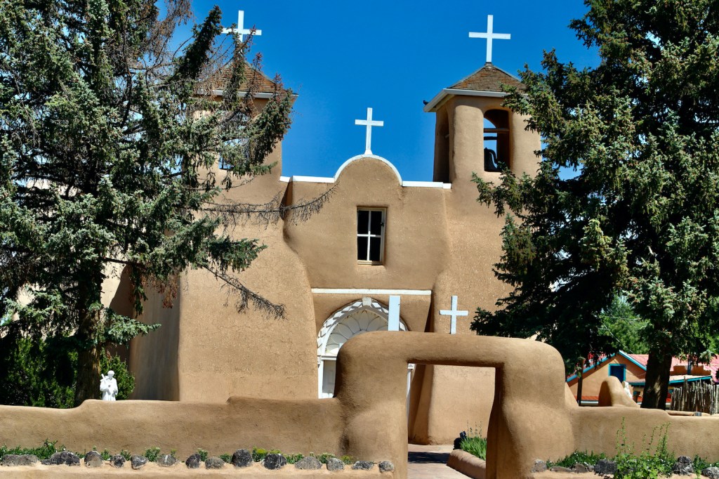
It is a large adobe structure, with a cruciform plan. An adobe wall extends from the back of the church and one of the transepts to form an enclosed rectangular area on the building’s south side. Adobe buttresses project from several portions of the main walls, including architecturally distinctive beehive-curved buttresses at the ends of the transepts. The roof is formed out of adobe laid on planking supported by timber vigas, set in distinctive doubly corbelled mounts. The vigas are also more closely spaced than is typically found in other examples of Spanish colonial architecture. The entrance is flanked by a pair of bell towers.
Next, we were to leap back in time again to see the ruins of ancient pueblo dwelling. The road (NM-518) to Pecos Pueblo site was a highlight in its own as it was abundant with spectacular views of the Sangre de Cristo Mountains’ rugged terrain and Carson National Forest.
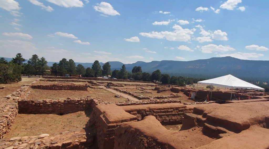
On the way to Pecos, we stopped in a quaint town of Las Vegas, that has preserved much of its character after it was established in 1835 by a group of settlers. Unlike Las Cruses, the town’s lay out still reflects the traditional Spanish Colonial style: a central plaza surrounded by buildings which could serve as fortifications in case of attack. While the streets are blinked by well-kept welcoming houses, there’s always a landmark around the corner, be it a fine example of Mission revival, Queen Anne, Victorian, or Richardsonian Romanesque styles. Las Vegas has its own unique flow of time and a special charm of the railroad era that makes you want to linger and forget about grand plans. Alas, the time in reality ran way faster and the next site on was not to be missed by all means. We were back on the road, ready to leap into prehistory again in the Pecos National Historical Park.
The major archeological and cultural landmark preserves the ruins of Pecos Pueblo. The first Pecos pueblo was one of two dozen rock-and-mud villages built in the valley around AD 1100. Within 350 years the Pecos village had grown to house more than 2,000 people in its five-storied complex. The Pecos people enjoyed a rich culture with inventive architecture and beautiful crafts. They also possessed an elaborate religious life, evidenced by the remains of over 20 ceremonial subterranean kivas. The main unit of the park also protects the remains of Mission Nuestra Señora de los Ángeles de Porciúncula de los Pecos, a Spanish mission near the pueblo built in the early 17th century. The site was abandoned in 1838, after the Pecos population suffered from marauding Comanches. The surviving remnant of the Pecos population moved to the Jemez Pueblo.
What a whirl of exploration! New Mexico is generous with its spectacular sights and encapsulates artifacts that symbolize turning points in the life of the societies that have populated this fascinating region throughout distinct epochs. History aside, not a single visitor would remain indifferent to the colors, shapes, and energy of this land. Until next time, bountiful New Mexico!